|
|
|
|
| Topo Trail Map | Map Legend | Bikerag Pictures |


|
|
|
|
| Topo Trail Map | Map Legend | Bikerag Pictures |
|
VT - Waterbury - Perry Hill (rasta trails) Mountain Bike Trail Review with Map and Pictures |
|||||||||||||||||||||||||||||||||||||||||||||||||||||||||||||||||||||||||||||
Trails CLOSED to
mountain bikes Nov 1st to May 30th |
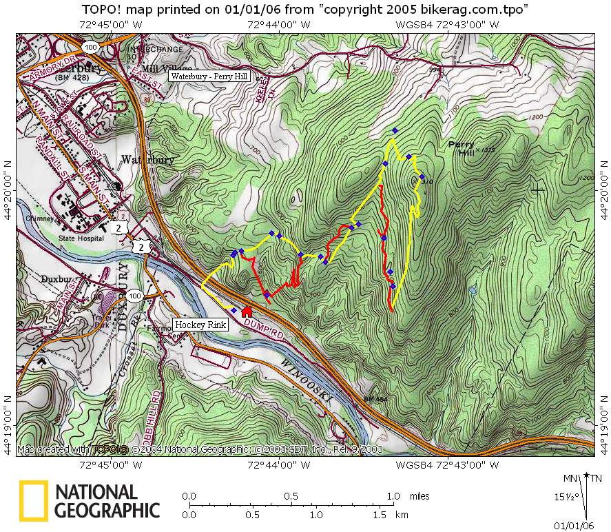
Directions - Route 89 to 100 south waterbury. Take left into skating rink before bridge (see map) Description - Hope its ok to post this place due to the recent articles I have seen published. Anyway, quite the gem of trails right off the highway. Really nice singletrack climbs and descents with a technical flare. Really nice flow, nice scenery. Some nice rock here and there to boot! Only one visit so the map is not near complete. Ill be back in 2006. The Perry Hill Trails are being maintained and managed by the Stowe Chapter of VMBA Please respect this place, DON'T EVEN THINK about riding here when its wet. Respect the locals.
Loops - Pre-ride Music: |
Total Miles: |
Elevation Change Feet - |
|
Disclaimer: Caution - Use this map at your
own risk. Bikerag.com and affiliates will not accept
responsibility for an personal injury, property damage or trespassing while
using this map. Trail users shall obey all signs, and always obtain
permission from the land owner to use trails for any sporting activity.
Permission to use trails should not be assumed. This map simply
contains topographical information and trails that existed at one time.
Trails shown maybe be missing, not accurate, closed, overgrown etc.... |
To
view larger version of map, right click on map and select View Image. |
| ||||||||||||||||||||||||||||||||||||||||||||||||||||||||||||||||||||||