|
|
|
|
| Topo Trail Map | Map Legend |


|
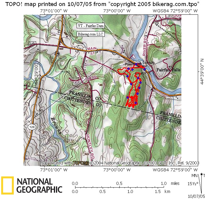
VT - Fairfax Dam - Mountain Bike Trail Review with Map and Pictures - Preliminary review |
|||||||||||||||||||||||||||||||||||||||||||||||||||||||||||||||||||||||||||||
Directions - Take 128 to fairfax, right on 104
east park at pulloff near dam. Trail entry is back down the road at
the bottom of the hill. |
Description - Not sure how much of this area I rode, but what I found was lots of short trails in a spiderweb like configuration on top.. Some nice singletrack, nice old school beginner trail features, and a couple nice drops.. Most of the trail was not that technical but did find a pretty sweet gonzo DH chute section through some rocks. I crashed, good stuff.. Low on the mileage, but pretty cool if your in the area.. No idea if there are more trails then shown on map. Loops - Pre-ride Music: |
Total Miles: 5 +??? |
Elevation Change Feet - |
|
Disclaimer: Caution - Use this map at your
own risk. Bikerag.com and affiliates will not accept
responsibility for an personal injury, property damage or trespassing while
using this map. Trail users shall obey all signs, and always obtain
permission from the land owner to use trails for any sporting activity.
Permission to use trails should not be assumed. This map simply
contains topographical information and trails that existed at one time.
Trails shown maybe be missing, not accurate, closed, overgrown etc.... |
To
view larger version of map, right click on map and select View Image. |
| ||||||||||||||||||||||||||||||||||||||||||||||||||||||||||||||||||||||