|
|
|
|
| Topo Trail Map | Map Legend | Bikerag Pictures |


|
|
|
|
| Topo Trail Map | Map Legend | Bikerag Pictures |
|
VA - Woodstock Tower - Massanutten West - Mountain Bike Trail Review with Map and Pictures |
|||||||||||||||||||||||||||||||||||||||||||||||||||||||||||||||||||||||||||||
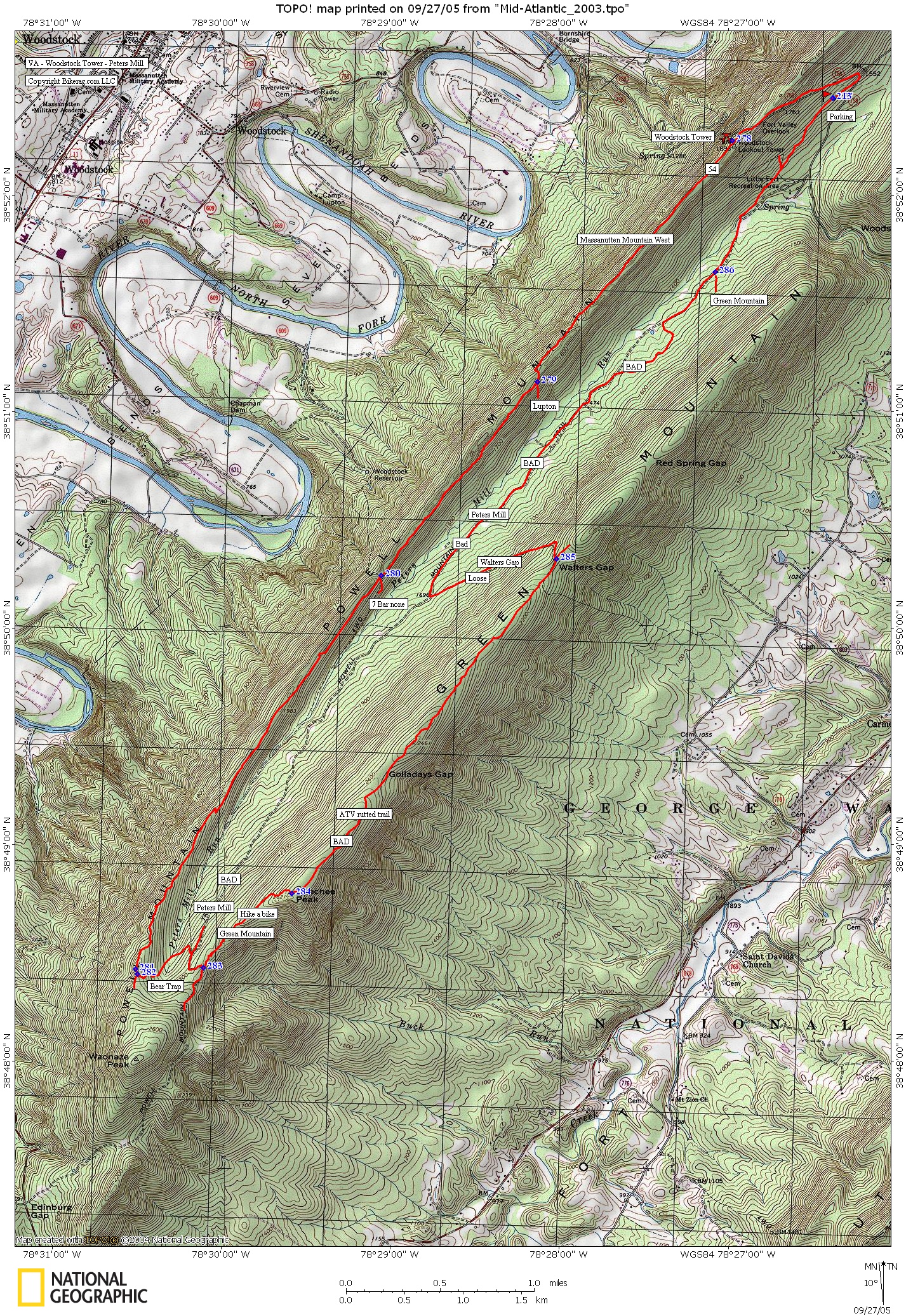
Directions - 81 to woodstock, take 665 to 758
up switchbacks, then down, look for parking for peters mill on right. |
Description - Massanutten trail was great, started off as rocky double track, nice view of 7 bends from clearing. Really nice off slightly off camber trail with a switchback or 2. Trail gets tighter in the middle, with some tough moves. A bit abandoned but easy to follow. Last section between 7 bar none and bear trap was pretty demanding, wore me down, trail drops 20 and climbs 100, multiple times.. All technical, lots of bear poohh, the fresh steamy stuff. Finally get to bear trap, but DON'T take it.. Abandoned trail, easy to follow but not worth it, crappy trail.. Don't take Green mountain or peters mill either.. Green mountain is basically bowling ball rocks with atv ruts, some challenging sections but mainly... Crap.. Some hike a bike on the way up. Walters gap was loose and challenging, but crap.. Peters mill, oh my god, what a focking joke, never will I listen to anyone about trails, may as well go in blind, peters mill is a ROAD.. A focking ROAD!!! So the skinny,Massanutten trail is good but not sure how to make a loop. Out and back may be the best. Loops - No good loops to my knowledge, try and out and back. If you go out and back park at woodstock tower instead of parking directions above. Pre-ride Music: |
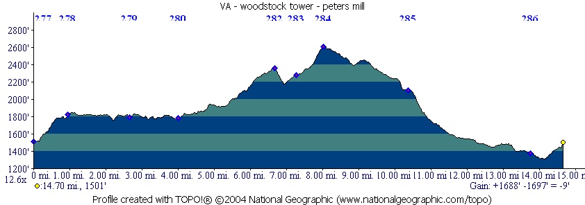
Total Miles: Our trip was 15 miles of pain |
Elevation Change Feet - |
|
Disclaimer: Caution - Use this map at your
own risk. Bikerag.com and affiliates will not accept
responsibility for an personal injury, property damage or trespassing while
using this map. Trail users shall obey all signs, and always obtain
permission from the land owner to use trails for any sporting activity.
Permission to use trails should not be assumed. This map simply
contains topographical information and trails that existed at one time.
Trails shown maybe be missing, not accurate, closed, overgrown etc.... |
To
view larger version of map, right click on map and select View Image. |
| ||||||||||||||||||||||||||||||||||||||||||||||||||||||||||||||||||||||