


|
UT - Gooseberry Mesa - Mountain Bike Trail Review with Map and Pictures |
|||||||||||||||||||||||||||||||||||||||||||||||||||||||||||||||||||||||||||
Update 2012:
After a week in Jackson hole, Zion was the first stop for the
mountain biking portion of my trip. Stopped in to Zion
Cycles and got the beta on Plenty of new trails in the area.
First stop was Gooseberry Mesa. 2 New trails have been added although
i'm not sure they are totally official. The Secret South rim and
Secret north rim. I cant speak for the north rim but the S. south rim
was a really good trail, a bit sandy at first, but it got better and better
as I progressed. Outstanding views, nice rock, nice singletrack and
you'll definitely avoid the crowds, might run into a lizard or 2. I
started out on normal south rim, to secret south rim (counter clockwise),
brings you back on south rim, then I cut over to the road for B-line to car.
Nice 12 mile loop. Secret north rim next time for sure! Love
riding in Zion. |
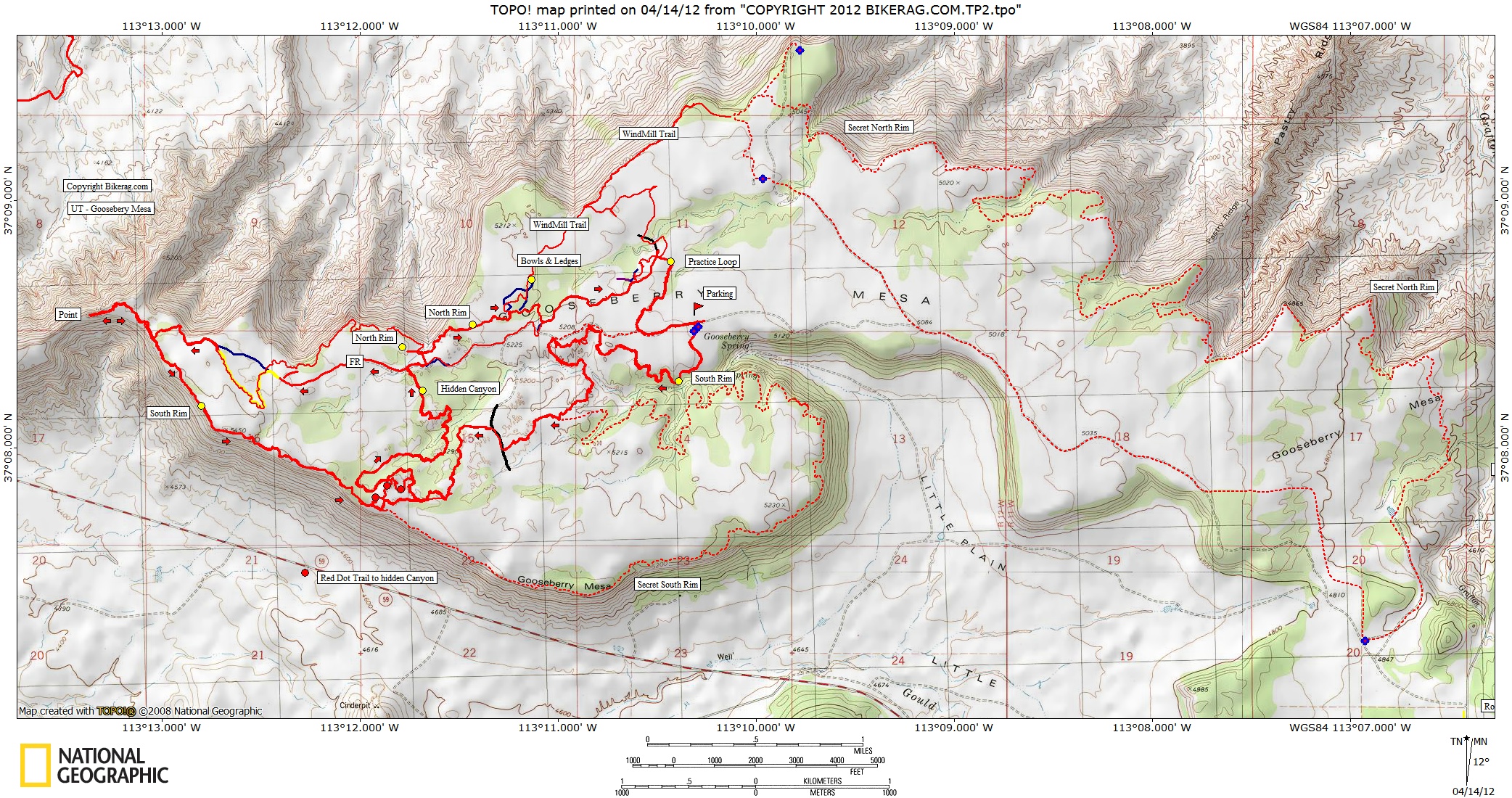
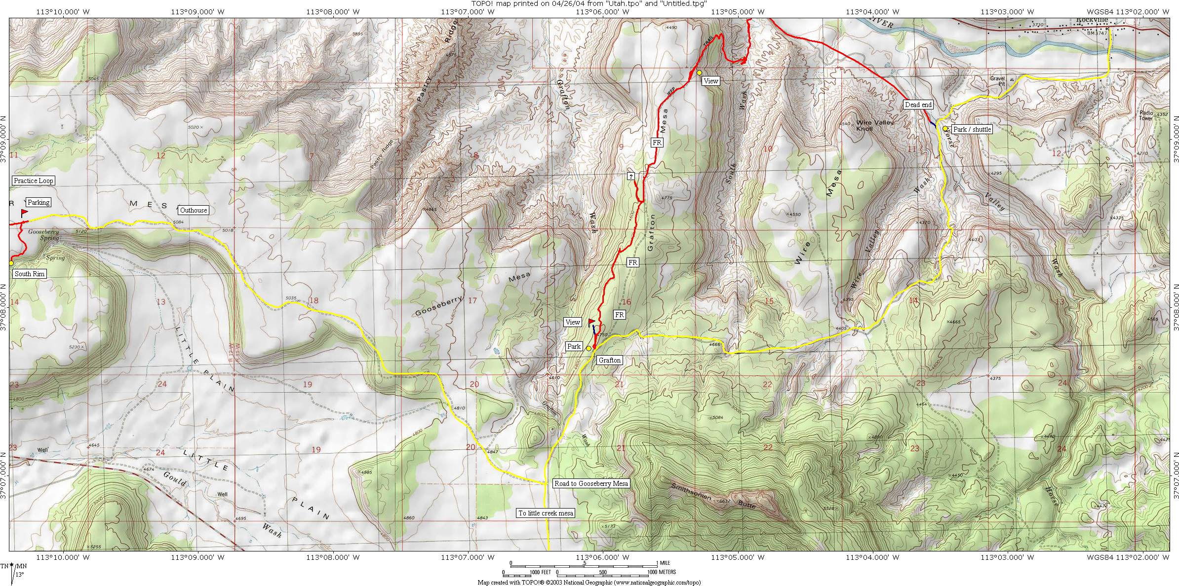
Directions - From Springdale, Flanigans Inn, go west on 9 exactly 4 miles to rockville and take a left onto bridge road, zero odometer, after bridge road curves right and turns into grafton road, follow uphill for 6.35 miles (from 9) and take a right.. drive 2.55 miles straight (there are some side roads) and take a left or bear left, now drive 1.04 miles to nice trailhead parking, on your way you may see people camping off to your left.. Description - All the slickrock you could ask for, and some excellent high-speed singletrack winding through moderate elevation scrub forests. Really fun lines, many short up and downs, nothing too gonzo.. Red dot trail is most technical, hidden canyon the most fun.. Killer area, your shoulders will be sore.. Its full on expert pretty relentless.. Loops - As suggested I tried the crazy 8 loop and it worked well.. South rim to red dot to hidden canyon left on fire road (or you can hit some north rim), to yellow trail sand bypass, to point, back on south rim to hidden canyon (skipping red dot), right on north rim, to practice loop, home.. Pre-ride Music: |
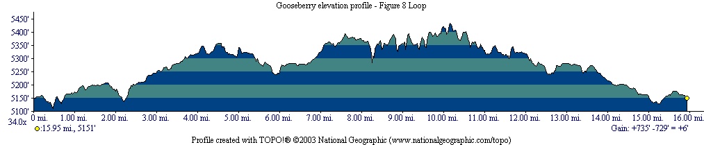
Total Miles: 18 mile loop described above,
probably 5 more miles of trails.. |
|
 |
Nearest Coffee, Sushi or other food: Springdale (foot of Zion NP) Pizza Noodle 5 Stars. Good beer (Polygamy Porter). Or OSCARS - Breaksfast!! LINNER!!
|
Disclaimer: Caution - Use this map at your
own risk. Bikerag.com and affiliates will not accept
responsibility for an personal injury, property damage or trespassing while
using this map. Trail users shall obey all signs, and always obtain
permission from the land owner to use trails for any sporting activity.
Permission to use trails should not be assumed. This map simply
contains topographical information and trails that existed at one time.
Trails shown maybe be missing, not accurate, closed, overgrown etc.... |
To
view larger version of map, right click on map and select View Image. |
| |||||||||||||||||||||||||||||||||||||||||||||||||||||||||||||||||||


