|
|
|
|
| Topo Trail Map | Map Legend | Bikerag Pictures |
|
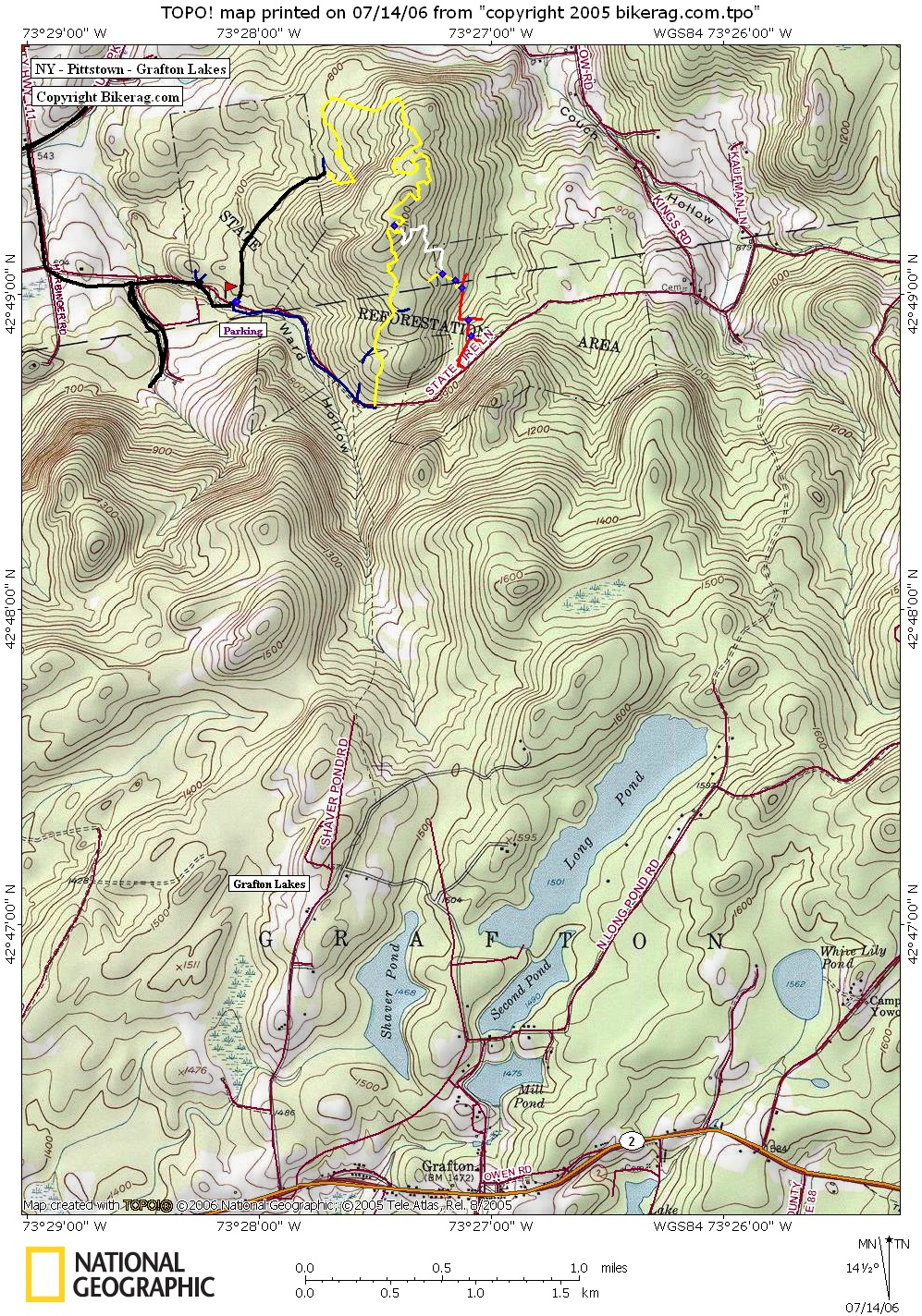
NY - Pittstown State Forest - Mountain Bike Trail Review with Map and Pictures 55% Preliminary Review (2 visits) |
|||||||||||||||||||||||||||||||||||||||||||||||||||||||||||||||||||||||||||||
Directions - From Albany, take Route 2 east to
278, take left on 278 north FOR 50 FEET, IMMEDIATE right onto tamarac road,
follow for 7.27 miles and take a right onto (Keefe??) road, follow for .96
miles take left, .3 miles take another left, soon you will pass a sign for
the state forest, continue past and look for parking area on your left..
large grassy open area, with boulders at edge where trail starts.. |
Description - Some pretty cool trails in here. Mainly rooty singletrack on the hill section, some nice rock and grass lined singletrack on top. I suggest following the yellow, the white trail I took this year was reall techy, but was a little bit abandoned. I hear there are many many more trails in the area and you can link grafton lakes state park trails to pittstown. Try to avoid after rain, it gets really muddy, takes a while to dry up from what I saw.. Loops - Pre-ride Music: |
Total Miles: 10 +++ |
Elevation Change Feet - Elevation
Profile |
|
Disclaimer: Caution - Use this map at your
own risk. Bikerag.com and affiliates will not accept
responsibility for an personal injury, property damage or trespassing while
using this map. Trail users shall obey all signs, and always obtain
permission from the land owner to use trails for any sporting activity.
Permission to use trails should not be assumed. This map simply
contains topographical information and trails that existed at one time.
Trails shown maybe be missing, not accurate, closed, overgrown etc.... |
To
view larger version of map, right click on map and select View Image. |
| ||||||||||||||||||||||||||||||||||||||||||||||||||||||||||||||||||||||