


|
NY - Ninham MUA - Mountain Bike Trail Review with Map and Pictures |
||||||||||||||||||||||||||||||||||||||||||||||||||||||||||||||||||||||||||||||
Update
2012 Ninham is officially OPEN again to mountain biking.
Thanks to the efforts of local mountain bike groups like
putnamriders.com
for working with the DEC to make the Ninham trails great! Please tread
lightly, do not build ramps and such as DEC can very easily close things
down again! |
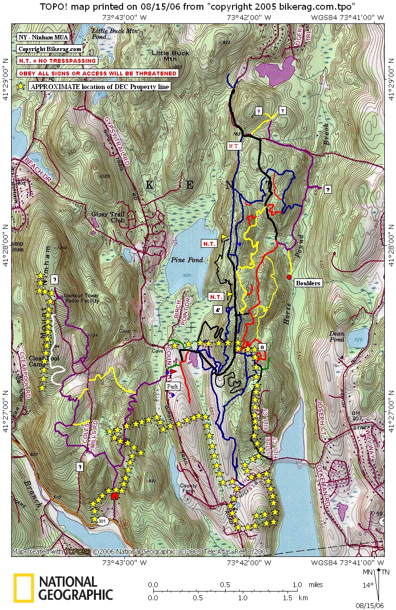
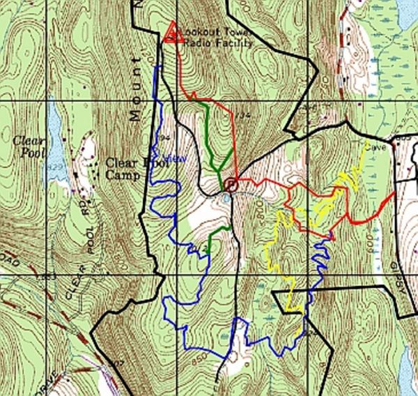
Upate 2011 Ninham is CLOSED to mountain biking. I hear conflicting info on why it was closed, trail building, jumps that were removed by authorities were put back up, who knows.. This was a great place to ride, with many natural features. Ill keep you posted if they open it back up to mountain biking. Update 2009: We avoided Ninham for a while due to hearsay of tickets but got the green light from some locals. You should still obey any signage in the park and stay within boundaries. Lots of new lines popped up, unfortunately, LOTS of new trail braids too, just like everywhere else. Improve your skill not the trail Directions - From CT take route 84 west into NY.. Go to Carmel and take exit for route 312, right at exit 1.25 miles take a right onto route 6.. 2.3 miles bear right at light onto route 52.. Travel .3 miles and take left on 301, .9 miles Bear right onto bridge, .33 miles (right at end of bridge!!) take a right onto Gypsy trail road, 1.95 miles take right and park in dirt lot.. Description - Some wicked cool Single track trails with slick rock and fun shtuff.. Lots of small rollers, lots of small drops, couple moderate drops.. Hats off to the trail builders and maintainers, this place is incredible, you will not be bored here, lost battered and confused, but not bored.. I really liked how there were so many obstacles scattered throughout this whole place.. Your on the fire road, about half way out and find 2 nice sleezy log rides to play on, or on some remote singletrack and find a nice walk the plank, shingled 2 footer, or crazy A-frame, or just natural huck, or short steep rock garden.. Its like this place was designed for me, I dont think the rating is too inflated but I do need to check out more of the terrain.. There is a whole trail network across the street also, Ill get right on that, more vert though for you flat-riders... Pre-ride Music: |
Total Miles: |
Elevation Change Feet - Elevation
Profile |
Nearest Coffee, Sushi or other food: Right
off route 6 you will find Deli's, G-store, Coffee, even sushi I think.. |
|
Disclaimer: Caution - Use this map at your
own risk. Bikerag.com and affiliates will not accept
responsibility for an personal injury, property damage or trespassing while
using this map. Trail users shall obey all signs, and always obtain
permission from the land owner to use trails for any sporting activity.
Permission to use trails should not be assumed. This map simply
contains topographical information and trails that existed at one time.
Trails shown maybe be missing, not accurate, closed, overgrown etc.... |
To
view larger version of map, right click on map and select View Image. |
| ||||||||||||||||||||||||||||||||||||||||||||||||||||||||||||||||||||||


