|
|
|
|
| Topo Trail Map | Map Legend | Bikerag Pictures |
|
NY - Jockey Hill - Mountain Bike Trail Review with Map and Pictures |
|||||||||||||||||||||||||||||||||||||||||||||||||||||||||||||||||||||||||||||
Thanks to "Fats in the Cats" for sending me a
map!!! |
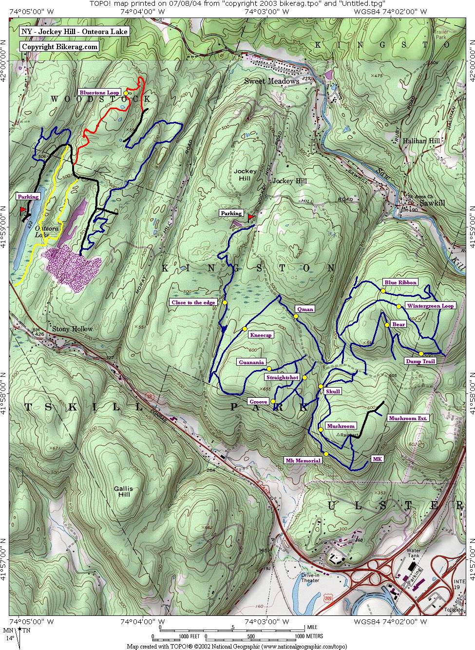
Directions - Take 209 to Sawkill Road (north or West direction), travel on sawkill for 2.49 miles, take a left on jockey hill road, follow to end and park at cul de sac.. Description - A decent place to ride but for me the trails all just seemed the same by the end of the ride.. There were some good sections, but too much of the same.. Moderate to mild technical in parts. The "on the edge" trail was the best one we encountered, most technical, twisty, lots of twiggling, and even a bridge.. Mushroom had some nice 1 footers, some flow.. All decent trails but to me nothing stellar.. Onteora lake was MUCH better, had a blast there.. Or you can ride BOTH, with some navigational skill.. Pre-ride Music: |
Total Miles: 12 ish |
Elevation Change Feet - |
|
Disclaimer: Caution - Use this map at your
own risk. Bikerag.com and affiliates will not accept
responsibility for an personal injury, property damage or trespassing while
using this map. Trail users shall obey all signs, and always obtain
permission from the land owner to use trails for any sporting activity.
Permission to use trails should not be assumed. This map simply
contains topographical information and trails that existed at one time.
Trails shown maybe be missing, not accurate, closed, overgrown etc.... |
To
view larger version of map, right click on map and select View Image. |
| ||||||||||||||||||||||||||||||||||||||||||||||||||||||||||||||||||||||