|
NH - Pawtuckaway State Park - Mountain Bike Trail Review with Map and Pictures |
|||||||||||||||||||||||||||||||||||||||||||||||||||||||||||||||||||||||||
Directions - Just take 93 north to 101
to 56 north and follow signs for the park.. |
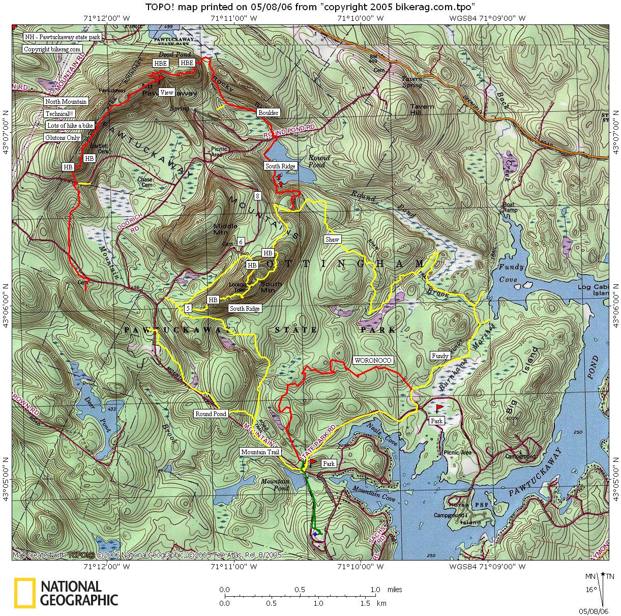
Description - This place rules.. Just one trip here and im hooked.. The trails here contain awesome rocky single & double track, wicked cool double track, slabs of granite to ride up and down with endless lines.. At the top, its a play ground.. Some sik downhills, then super fast technical descents LITTERED with fun 1-2.5 foot drops that even I can handle.. Some slow technical trails too.. Stop reading and pack your car - you'll have a blast.. UPdate 2006: Woronoco trail is great - thanks NEMBA.org!! UPDATE: North mountain trail is not suggested for humans with bikes.. Awesome riding at the top, but getting there is a biatch.. 500 foot hike a bike up, 200 or so down.. South ridge between shaw and boulder was VERY cool, follow the arrows.. Boulder was good, just a few hike a bikes.. You go right by a popular climbing spot!! Everyone else did this loop counter clockwise but I suggest you try this simply awesome loop: Park at 2 on the state map, travel up mountain trail and take a right on 5 (south ridge trail), some hike a bike up and a bit on the down, right on shaw trail at 8, awesome downhill, right on 4 (fundy trail) easy, right on 3 road ride home.. Pre-ride Music: Chemical
Bros. - Brothers gonna work it out - "Mars Needs women" |
Total Miles: 20?? |
Suggested LOOP -
Think Clockwise. Depending where you start (if the park is OPEN or
not), you will either start or end on woronoco.. From park entrance,
ride down road and look for left on Mountain trail, go up mountain trail,
make sure and bear right at round pond.. Take next right up south
ridge, some hikea bike.. Tough climb, then sweet descent, 50 ft
of hike a bike on the way down, if your good.. Right on shaw, right on
fundy, right on woronoco, left on mountain, right on road back to car.
13 miles or so, 1000 vertical. |
Elevation Change Feet - about 1000 vert in 10
miles |
| ||||||||||||||||||||||||||||||||||||||||||||||||||||||||||||||||||||


