|
|
|
|
| Topo Trail Map | Map Legend | Bikerag Pictures |
|
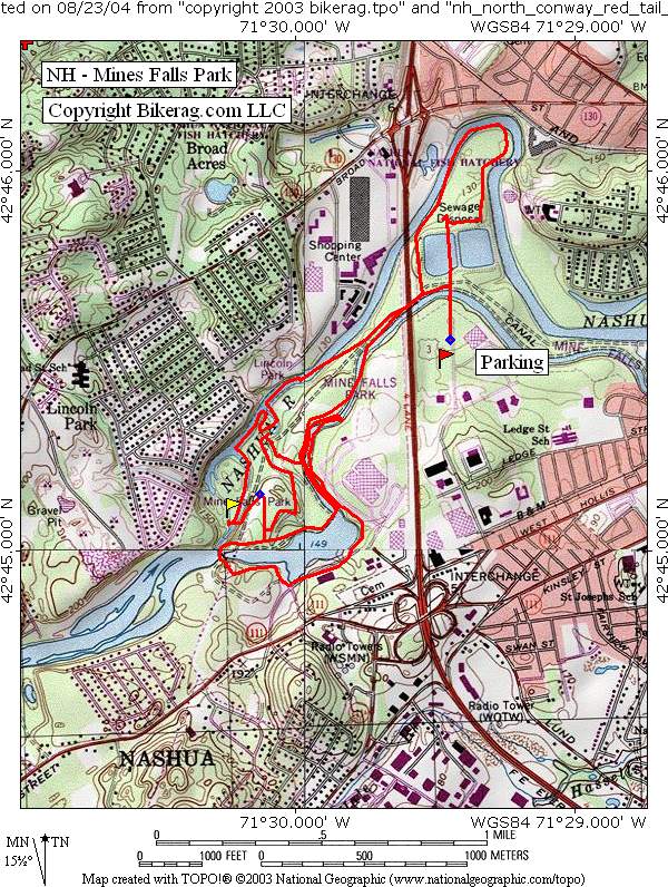
NH - Mine Falls Park Mountain Bike Trail Review with Map and Pictures |
|||||||||||||||||||||||||||||||||||||||||||||||||||||||||||||||||||||||||||||
Directions - Take Route 3 north towards
Nashua, NH, get off exit 5 A, then left on Simon St., another left on
Whipple St, park at end.. |
Description - This place wasnt a bad place for a quick, smooth spin.. The trails range from pavement to buff fourple track, to single track, super buff.. This place is the size of a 37 cent postage stamp but is filled with trails and trail users, its a busy park.. You really don't need a map, just ride everything, we found a couple cool highlights, one nice singletrack along the river or canal, one cool rock garden section, some nice waterfall views, a crazy bird, one gravity cavity.. There are many little side trails and if you explore them all you might find a technicality or 2.. So if your in traffic on route 3, stuck with your radiator steeming, get off, get off the highway that is and take a quick spin.. Nothing stellar, but lets just say, it doesn't totally suck.. Pre-ride Music: |
Total Miles: 10ish |
Elevation Change Feet - Elevation
Profile |
|
Disclaimer: Caution - Use this map at your
own risk. Bikerag.com and affiliates will not accept
responsibility for an personal injury, property damage or trespassing while
using this map. Trail users shall obey all signs, and always obtain
permission from the land owner to use trails for any sporting activity.
Permission to use trails should not be assumed. This map simply
contains topographical information and trails that existed at one time.
Trails shown maybe be missing, not accurate, closed, overgrown etc.... |
To
view larger version of map, right click on map and select View Image. |
| ||||||||||||||||||||||||||||||||||||||||||||||||||||||||||||||||||||||