|
|
|
|
| Topo Trail Map | Map Legend | Bikerag Pictures |
|
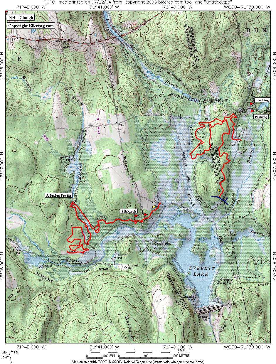
NH - Clough - Hopkinton Everett Reservoir - Mountain Bike Trail Review with Map and Pictures Very Preliminary Review |
|||||||||||||||||||||||||||||||||||||||||||||||||||||||||||||||||||||||||||||
Directions - From concord take 89 north to exit
for route 13 south at junction of 77 follow 13 LEFT, .8 miles take a right
onto winslow road, travel .6 miles, right, then one more mile you will end
up at the ohrv parking area.. |
Description - Ok first of all, don't say I didn't warn you, this place is not for the timid.. And you will have difficulty staying away from the motorized traffic, they are everywhere, and can ride here legally, one of the few state parks where they can.. That being said, let me describe to you the trails we found.. Knowing all the ATV traffic, I was in search of singletrack, so the sign had 2 loops labeled SINGLETRACK, max 36" width.. The BT loop and river loop.. Hit them both.. Both great trails with a huge disclaimer attached You hit awesome rocky technical gonzo gallore sections, but lots of hike a bike due to rutted trails or soft areas from motorized traffic.. OH well, could be great but its still good.. Even found some slickrock on the river trail.. Those trails are really brutal, ride both of them and you will be beaten to a pulp.... I would avoid any trail that ATV's are allowed on for your safety!! The rocky singletrack trails do not get much MX traffic, we ran into 3 riders... I hear there is some secret single track but I need better directions to find it.. Anyone?? Bueller? Help me out, Ill spread the good word.. Pre-ride Music: |
Total Miles: 30 ++++ ---- ???? |
Elevation Change Feet - 15 miles was only a mear
500 vert.. Ouch.. |
|
Disclaimer: Caution - Use this map at your
own risk. Bikerag.com and affiliates will not accept
responsibility for an personal injury, property damage or trespassing while
using this map. Trail users shall obey all signs, and always obtain
permission from the land owner to use trails for any sporting activity.
Permission to use trails should not be assumed. This map simply
contains topographical information and trails that existed at one time.
Trails shown maybe be missing, not accurate, closed, overgrown etc.... |
To view
larger version of map, right click on map and select View Image. |
| ||||||||||||||||||||||||||||||||||||||||||||||||||||||||||||||||||||||