|
|
|
|
| Topo Trail Map | Map Legend |


|
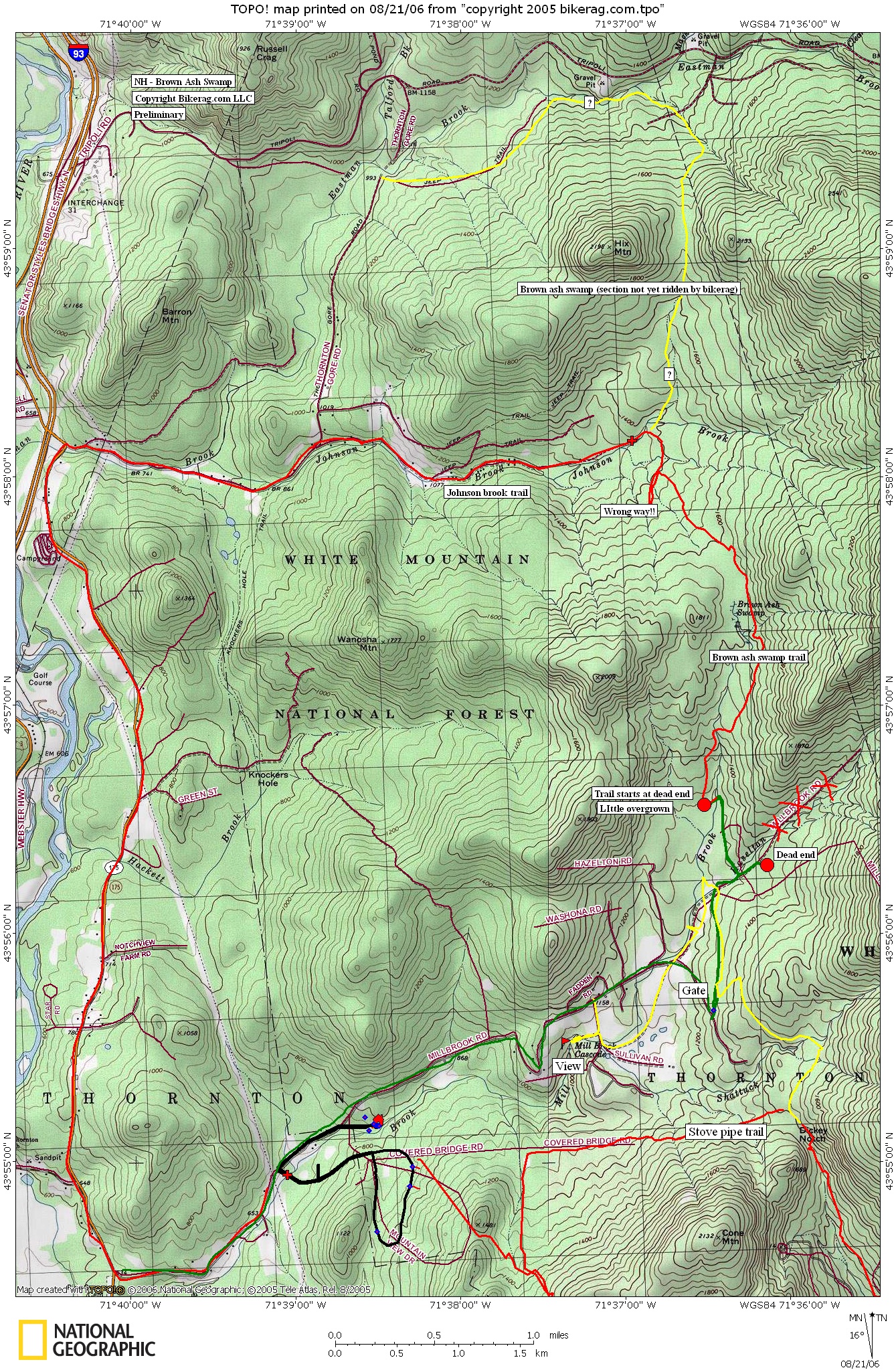
NH - Brown ash swamp trail - Mountain Bike Trail Review with Map and Pictures Preliminary |
|||||||||||||||||||||||||||||||||||||||||||||||||||||||||||||||||||||||||||||
Directions - Take 93 to exit 28, right at
exit, 49 east, left on route 175, then RIGHT on mill brook.. Follow
mill brook 4 miles and park at gate on left, do not block gate. |
Description - I finally checked out 1/2 of the brown ash swamp trail. Trail starts as a wide grassy road, follow bike signs, at dead end look for overgrown trail, once you walk in it opens up, a bit.. Trail was mild to moderately overgrown with about 10 blowdowns that could be easily cleared with a trail saw.. Started out pretty easy, mild technicalities, couple moderate ones on the DH section, nothing too crazy.. Could be an OK trail but not maintained.. I bailed at the 1/2 way point on johnson brook trail, but will map ou the rest at some point. Loops - Looks like a few ways to ride this area but will need to investigate.. I rode from the gate to johnson brook, and took the road ALL THE WAY HOME.. Too much road.. Other option would be out and back to Tripoli Road, or a lariat using johnson brook road and Thronton gore road. Pre-ride Music: |
Total Miles: |
Elevation Change Feet - |
|
Disclaimer: Caution - Use this map at your
own risk. Bikerag.com and affiliates will not accept
responsibility for an personal injury, property damage or trespassing while
using this map. Trail users shall obey all signs, and always obtain
permission from the land owner to use trails for any sporting activity.
Permission to use trails should not be assumed. This map simply
contains topographical information and trails that existed at one time.
Trails shown maybe be missing, not accurate, closed, overgrown etc.... |
To
view larger version of map, right click on map and select View Image. |
| ||||||||||||||||||||||||||||||||||||||||||||||||||||||||||||||||||||||