|
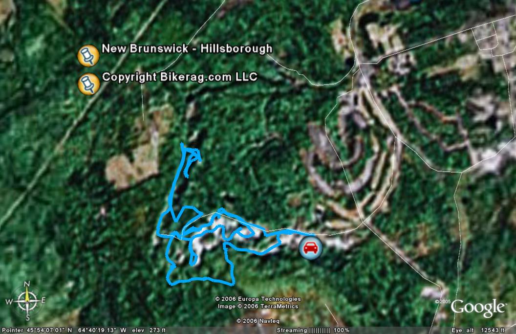
New Brunswick - Hillsborough - Mountain Bike Trail Review with Map and Pictures |
||||||||||||||||||||||||||||||||||||||||||||||||||||||||||||||||||||||||||||||||
Directions - From Moncton, take 114 south to
Hillsborough, once in town, look for a right on golf club road, bear right
at the first fork, pass a road on your left, drive into sand pit area and
park.. you will see a gate on your right and the edge of the golf
course.. |
Description - We rode part of the race course here, its an interesting place.. The start is up some white rock fire roads, it was wet so first you get a good inch of toxic red mud on your tires, then you ride through the white rocks and listen to them bounce off your now 40 lb bike.. Once we found the race course it started out with normal dirt 1/5 track, even some burms and a JUmp - whoo hoo.. Back to the fire road, we explored around, and eventually found some of the cool white rock single track, and the mogul section.... ST was good but we didn't find too much.. This was the best ride we found in New Brunswick.. Hopewell rocks is right up the road if you want some tourism and the red tide is right... Im sure ill have some shots in fantastic pics soon.. Map to come at some point, not sure it will help. Loops - Good Luck Pre-ride Music: Billy
Idol - White Wedding |
Total Miles: 10 ish?? |
Elevation Change Feet - ?? |
Nearest Coffee, Sushi or other food: Best
bet is to go back to Moncton - we found some eats an hour away on 114 on the
scenic route.. |
|
|
Disclaimer: Caution - Use this map at your
own risk. Bikerag.com and affiliates will not accept
responsibility for an personal injury, property damage or trespassing while
using this map. Trail users shall obey all signs, and always obtain
permission from the land owner to use trails for any sporting activity.
Permission to use trails should not be assumed. This map simply
contains topographical information and trails that existed at one time.
Trails shown maybe be missing, not accurate, closed, overgrown etc.... |
To
view larger version of map, right click on map and select View Image. |
|
| ||||||||||||||||||||||||||||||||||||||||||||||||||||||||||||||||||||||


