|
|
|
|
| Topo Trail Map | Map Legend | Bikerag Pictures |


|
|
|
|
| Topo Trail Map | Map Legend | Bikerag Pictures |
|
MA - Lowell Dracut Tyngsboro state forest - Mountain Bike Trail Review with Map and Pictures |
||||||||||||||||||||||||||||||||||||||||||||||||||||||||||||||||||||||||||||||||||||||
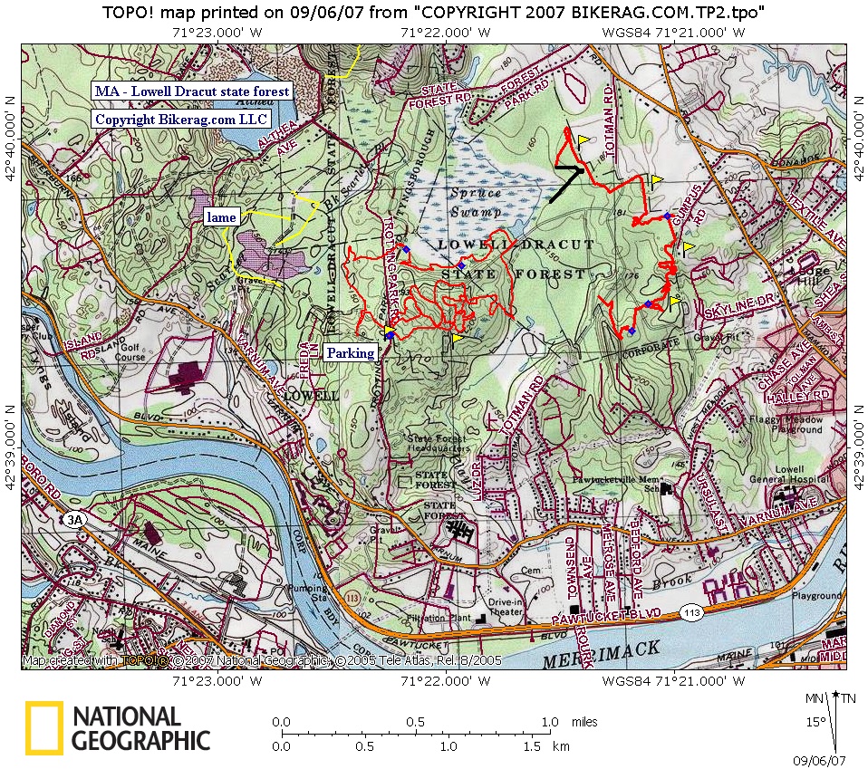
Directions - From the South: Take Rt. 495
to Rt. 3 north. Follow Rt. 3 North to exit 32. Go right at |
the end of ramp, onto Drum Hill Rd. go 5 sets of lights (bear Left) you will cross over the Rourk Bridge. Go left at the lights on the other side of the bridge. Go 500 yards then take a right at lights onto Old Ferry Rd. Take a left onto Varnum Ave. After ½ mile, go right onto Trotting Park Rd. Parking lot is at the gate. Update 2007 PART II - Rode the latest Nemba trail, it is awesome.. Some amazing trail work in there with great natural features. Trail resembles the work at vietnam, its more XC or cross stuntry, but utilizes the natural terrain perfectly!! Go check it out.. Update 2007 - PMD and I finally rode here and liked it.. Funny thing is I went to school at U-lowell and never even heard of this park just a mile or so from the school.. Nice mix of trails, Pine needle forest with some nice singletrack and well worn doubletrack.. Bonus features started popping up as we explored some boulder areas. Some pretty cool lines including a few nice moderate drops, rollers, ups and stuff.. Good fun rock.. Me likey.. http://www.mass.gov/dcr/parks/northeast/ldtf.htm Description - Super buff fast XC with some bonus
rollers thrown in. No hills. No trail blazes at all. Local Nemba Chaper - http://mv-nemba.org
Pre-ride Music: |
Total Miles: |
Elevation Change Feet - |
|
Disclaimer: Caution - Use this map at your
own risk. Bikerag.com and affiliates will not accept
responsibility for an personal injury, property damage or trespassing while
using this map. Trail users shall obey all signs, and always obtain
permission from the land owner to use trails for any sporting activity.
Permission to use trails should not be assumed. This map simply
contains topographical information and trails that existed at one time.
Trails shown maybe be missing, not accurate, closed, overgrown etc.... |
To
view larger version of map, right click on map and select View Image. |
| |||||||||||||||||||||||||||||||||||||||||||||||||||||||||||||||||||||||||||||||