|
|
|
|
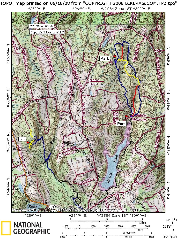
| Topo Maps Posted Map see pics |
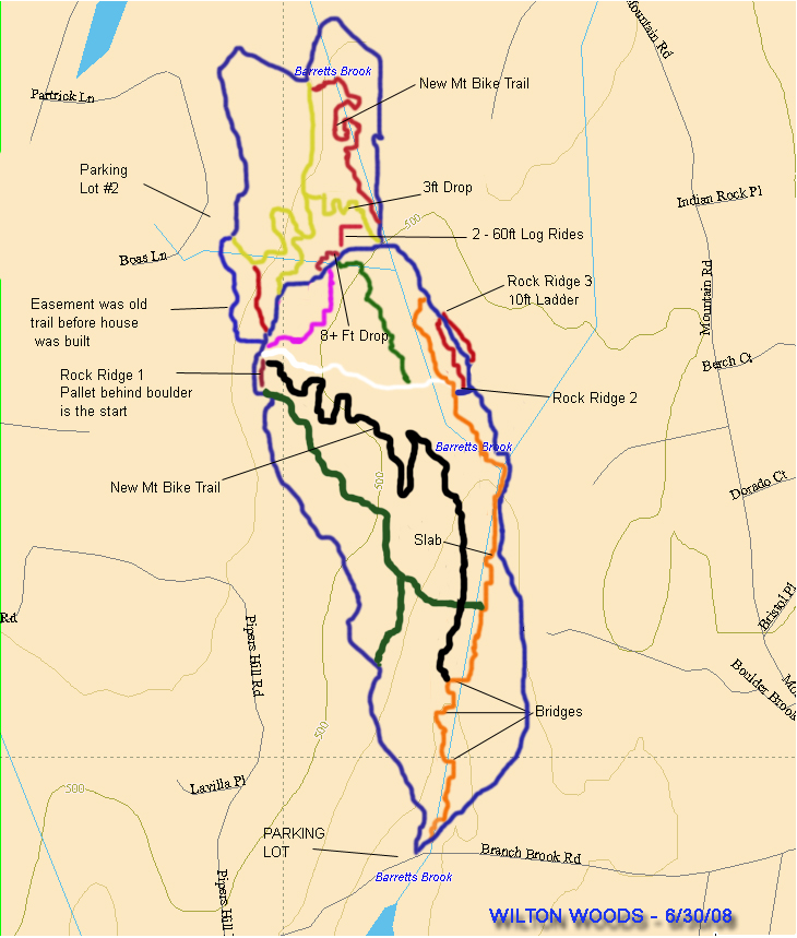
Map Legend | Bikerag Pics |


|
|
|
|
| Topo Maps Posted Map see pics |
Map Legend | Bikerag Pics |
|
CT - Wilton Woods - Mountain Bike Trail Review with Map and Pictures |
|||||||||||||||||||||||||||||||||||||||||||||||||||||||||||||||||||||||||||
Directions - From route 15 take route 33 north,
merges with route 7 north at light, then once on 7 north go 2.8 miles and
take a left on Olmstead Hill road.. .79 miles take your 4th right on
chicken road to end, take left, .43 miles park on right.. Small lot,
only about 5 cars but I guess you could park on the road.. |
Description - Pretty small place but cool trails.. Mainly moderately rocky singletrack, pretty flat, with several industrial type bridges.. Outer loop is 3 miles (blue).. All trails are said to be about 7 miles.. Loops- Ride the blue counter clockwise Pre-ride Music: ICE-T
- Body Count |
Total Miles: 7 |
Elevation Change Feet - 207 feet |
|
|
Disclaimer: Caution - Use this map at your
own risk. Bikerag.com and affiliates will not accept
responsibility for an personal injury, property damage or trespassing while
using this map. Trail users shall obey all signs, and always obtain
permission from the land owner to use trails for any sporting activity.
Permission to use trails should not be assumed. This map simply
contains topographical information and trails that existed at one time.
Trails shown maybe be missing, not accurate, closed, overgrown etc.... |
Posted Map see 'Pics' |
| |||||||||||||||||||||||||||||||||||||||||||||||||||||||||||||||||||