|
CT - Talcott Mountain - Mountain Bike Trail Review with Map and Pictures |
|||||||||||||||||||||||||||||||||||||||||||||||||||||||||||||||||||||||||||
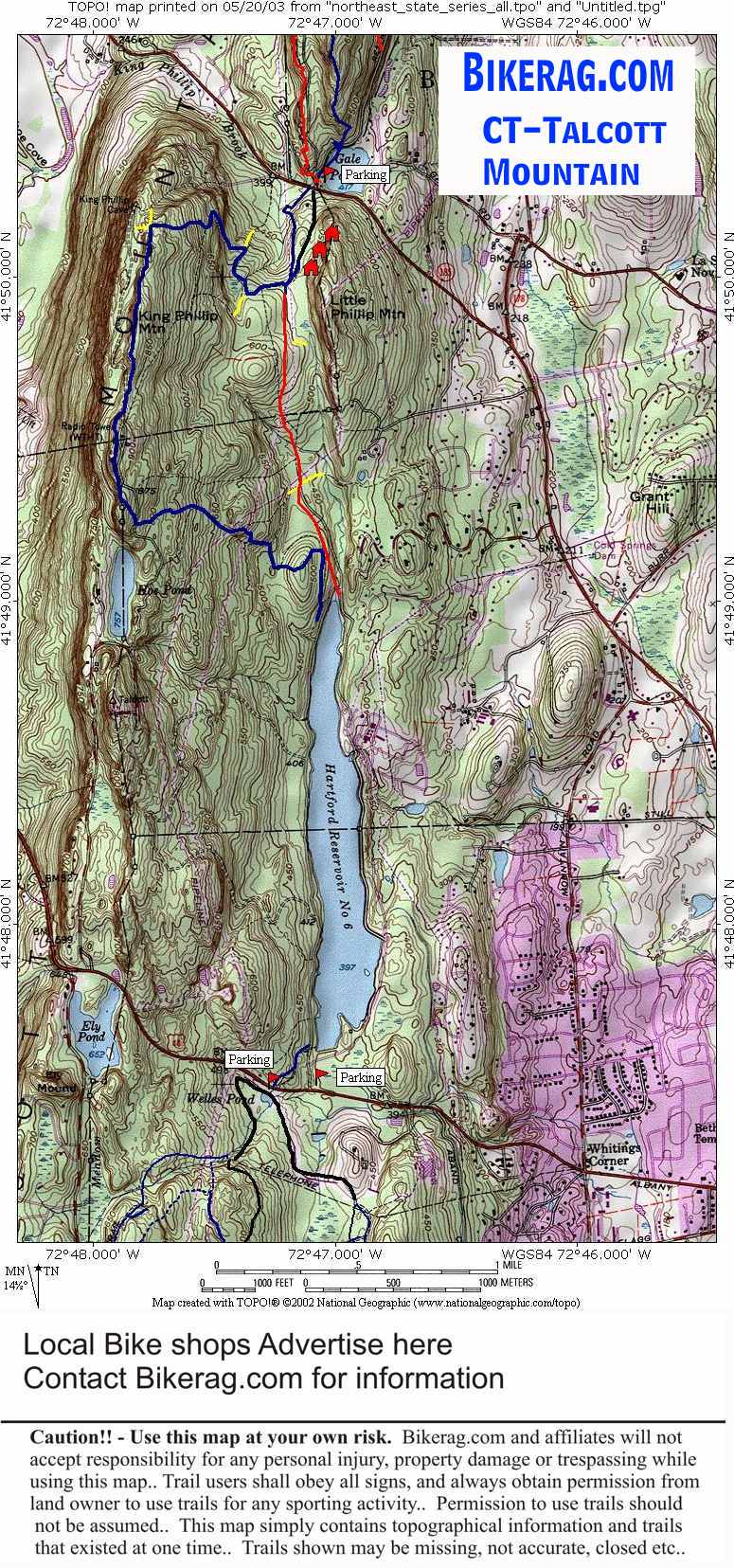
Directions - From west hartford - take
farmington ave, right turn on mountain road, left on route 44, 1.1 miles
look for reservoir #6 parking lot on right.. IF that lot is full, drive
another 100 feet up the road and park on dirt pull off on left.. |
Description - BEWARE - there are lots and lots and lots of NO-Bikes signs.. Its bizarre.. There is a sign with bikes, hikers etc, denoting that its a multi-use area.. But most trails have no-bikes signs.. We managed to do a loop only passing one sign (middle of trail - go figure).. I didn't see ANY no hikers signs!!! In any case, there are lots of hikers so warn them of your approach, go slow, get off your bike, do what you can do not disturb them.. Im so PC.. Anyway - many of the trails here are beginner.. Wide fire roads, double track.. The blue metacomet is pretty dam nice singletrack but may be off limits to bikes in sections.. Fantastic views, some techs, lots of people.. This place is a zoo on the weekends, I have even seen people hanglide here. Loops - Good spot for mini-epics between whres and penwood.. Pre-ride music: |
Total Miles: 13ish |
Elevation Change Feet - Climb up Talcott
mountain is 500 ft. |
|
| ||||||||||||||||||||||||||||||||||||||||||||||||||||||||||||||||||||||


