|
CT - Nipmuck - Middle, Nipmuck Natchaug, Mansfield Hollow - Mountain Bike Trail Review with Map and Pictures |
|||||||||||||||||||||||||||||||||||||||||||||||||||||||||||||||||||||||||
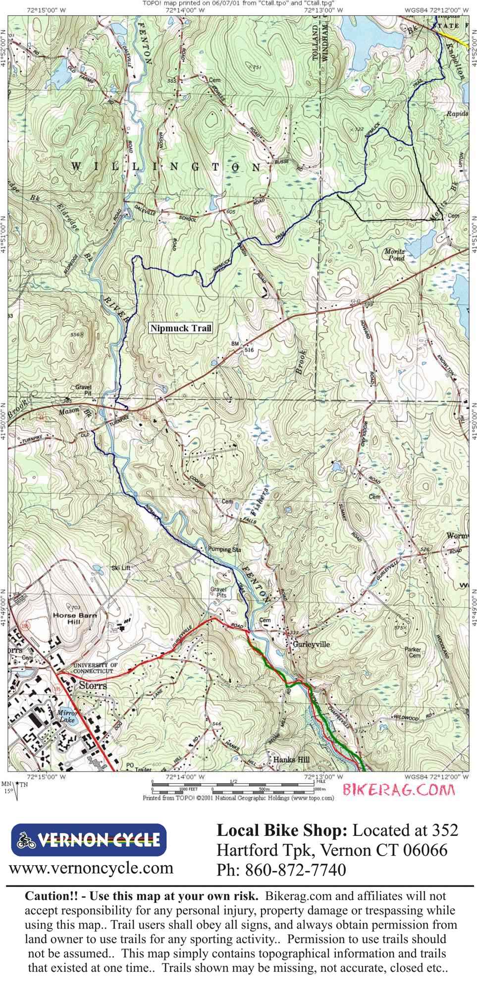
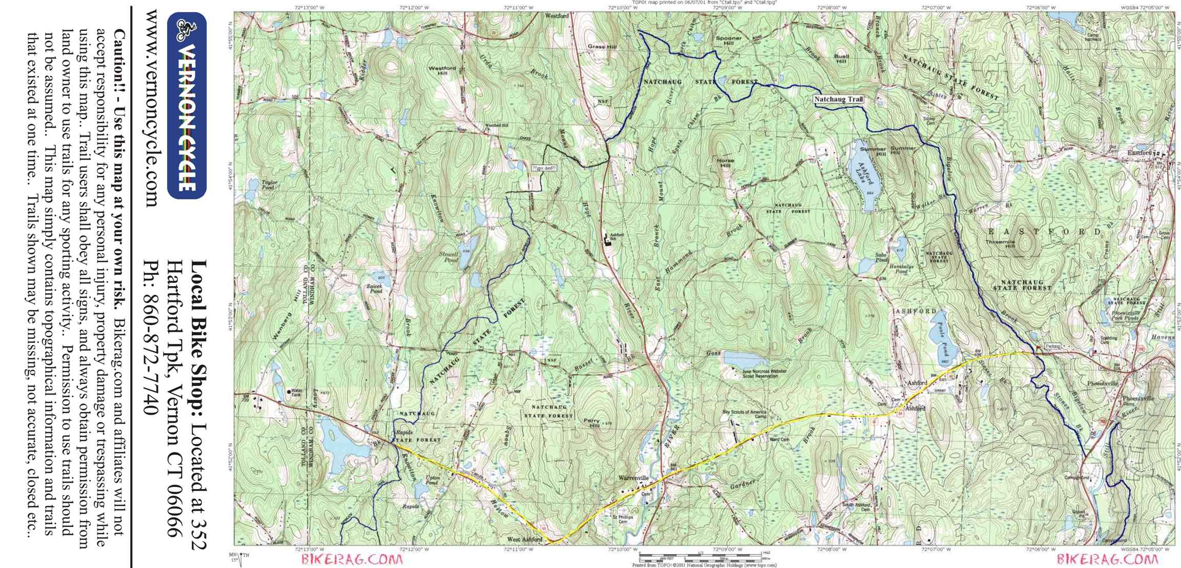
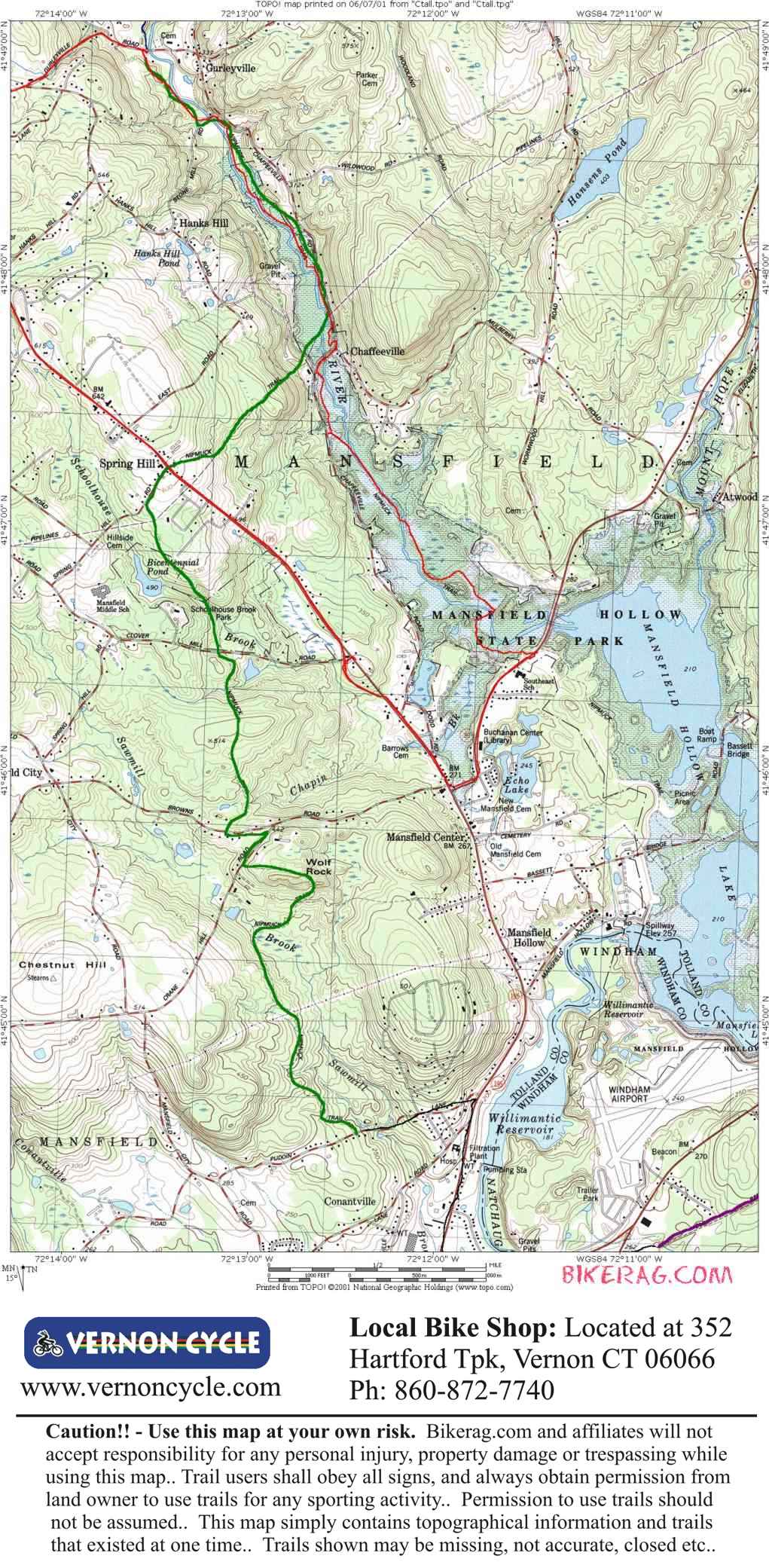
Directions - Take rte 84 east, to exit 69, right at exit, Follow for ROUGHLY 5 miles
through some lights up and down huge hills, look for the blue elliptical sign and
park past the sign on the right, or farther past the sign on the left. You
can follow the trail north or south. North loop can hook up with the
natchaug, south loop is out and back.. |
Description - The nipmuck trail is mainly a hiking trail and has some no-bikes signs posted on some sections. Make sure and hike these sections as im sure if that rubber touches the trail there will be an environmental disaster equivalent to Exxon Valdez. Anyway - be nice to any hikers you may see on the trail and they might not bludgeon you with their walking sticks.... The trail here is very nice single track with some rock gardens, not that hilly and as far as I know - pretty much an out and back (unless you want to do the whole 45 mile nipmuck natchaug loop). Some nice views, a bit of fire road riding required with some nice single track along the river. Pre-ride Music: |
Total Miles: 5 out 5 back |
Elevation Change Feet - Elevation
Profile |
|
To
view larger version of map, right click on map and select View Image. |
| |||||||||||||||||||||||||||||||||||||||||||||||||||||||||||||||||||