|
|
|
|
| Topo Map of Area | Map Legend | Bikerag Pics |
|
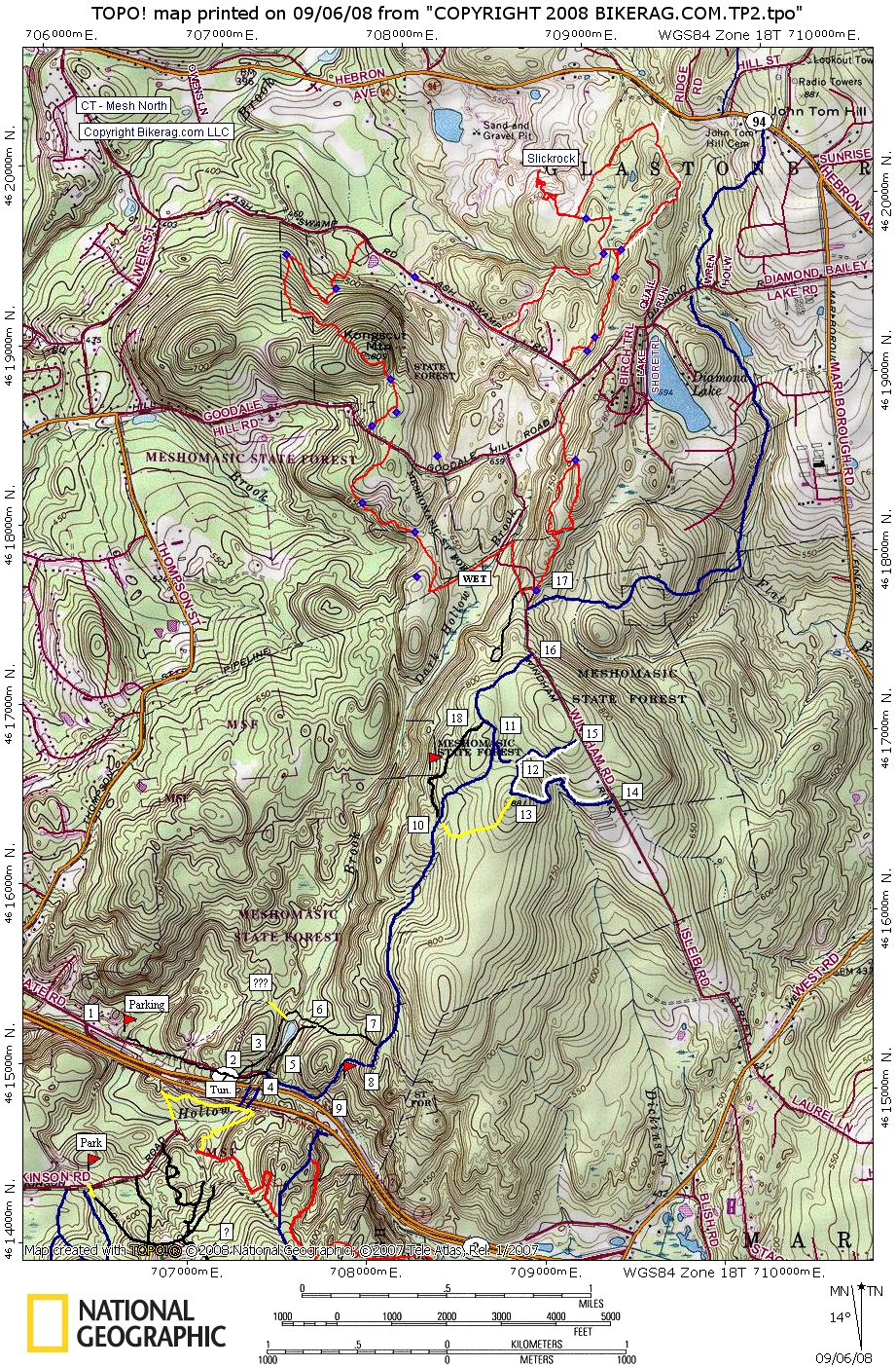
CT - Meshomasic North - Mountain Bike Trail Review with Map and Pictures |
|||||||||||||||||||||||||||||||||||||||||||||||||||||||||||||||||||||||||||
Directions - Its easy - from rte 2 north
take exit 11, right at exit, drive like 50 ft and park at dead end by
gate. From north take exit 10 C.C. road right at exit, left at stop,
follow road back over highway and down to dead end parking area. |
Update 2008: Few more trails are kicking around the mesh north area, some cool stuff, fair amount of climbing, some nice singletrack, and even a patch of slickrock. Lots of wildlife in this area - Fisher Cats, Rattle snakes, Turkey vultures, deer, its the freakin wild kingdom of CT.. Description - Some decent trails here that are seldom ridden by mountain bikers. A nice combination of fire roads, double track, single track and pavement if you like.. Some very winding sandy cape-cod-esque single track sections are blue white and yellow. Not a lot of rocks, but not necessarily as smooth as my butt either. A few fun drops, and rocks, I even went over the bars in a stream. Pre-ride Music: Anything
by Sting, or Blind melon |
Total Miles: 12 |
Elevation Change Feet - |
|
Disclaimer: Caution - Use this map at your
own risk. Bikerag.com and affiliates will not accept
responsibility for an personal injury, property damage or trespassing while
using this map. Trail users shall obey all signs, and always obtain
permission from the land owner to use trails for any sporting activity.
Permission to use trails should not be assumed. This map simply
contains topographical information and trails that existed at one time.
Trails shown maybe be missing, not accurate, closed, overgrown etc.... |
To
view larger version of map, right click on map and select View Image. |
|
| |||||||||||||||||||||||||||||||||||||||||||||||||||||||||||||||||||