|
|
|
|
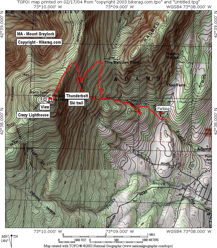
| Topo Map of Area | Map Legend | Pics |
|
MA - Mount Greylock Review - Ski - Hike - BIke - Snowshoe |
||||||||||||||||||||
|
||||||||||||||||||||
| Directions- mountain road to right on Gould
road to right on theil road, park at end, near center of town in adams
mass.. get a map, youll find it.. Description - Loops- |
||||||||||||||||||||
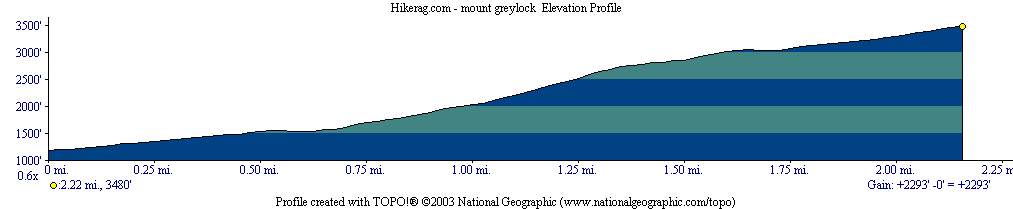
| Elevation Profile | ||||||||||||||||||||
| Total Miles : 2.5 out, 2 back for a total of 4.5ish miles | ||||||||||||||||||||
| Nearest Coffee, Sushi or other food: | ||||||||||||||||||||
| Disclaimer: Caution - Use this map at your own risk. Hikerag.com and affiliates will not accept responsibility for an personal injury, property damage or trespassing while using this map. Trail users shall obey all signs, and always obtain permission from the land owner to use trails for any sporting activity. Permission to use trails should not be assumed. This map simply contains topographical information and trails that existed at one time. Trails shown maybe be missing, not accurate, closed, overgrown etc.... | ||||||||||||||||||||
 |
||||||||||||||||||||


