|
|
|
|
| Topo Trail Map | Map Legend | Bikerag Pictures |


|
Coopers Rock state park - West Virginia - Mountain Bike Trail Review with Map and Pictures |
|||||||||||||||||||||||||||||||||||||||||||||||||||||||||||||||||||||||||||||
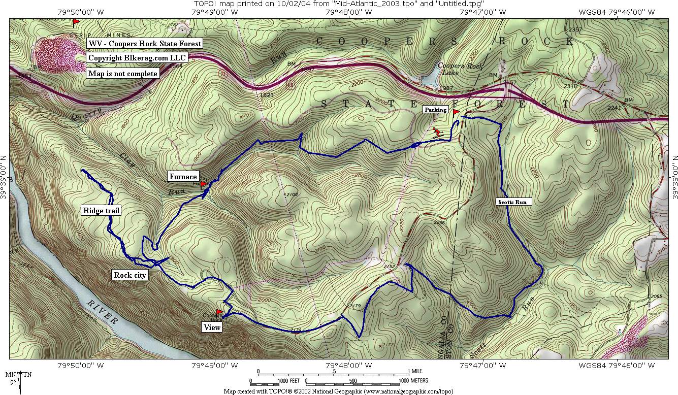
Directions - From cumberland MD area, take 68
west to exit 15, left at exit, first parking area on right. XC ski
trail starts out by smelly bathroom. |
Description - Nothing to write home about here, mediocre trails, nice views, not much singletrack.. Some rocky trails but really just numbing stutter bump stuff, which just gives you a case of tennis elbow.. The Rock city trail was the only worthy trail, starts by cabin and goes into laurel tunnel - follows some steep walls, some neat caves.. Keep following it to ridge trail and there are some nice 1 footers.. Loops - Pre-ride Music: |
Total Miles: |
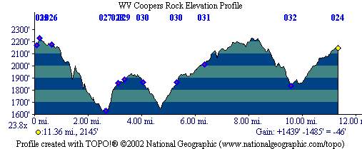
Elevation Change Feet - 1500 |
|
Disclaimer: Caution - Use this map at your
own risk. Bikerag.com and affiliates will not accept
responsibility for an personal injury, property damage or trespassing while
using this map. Trail users shall obey all signs, and always obtain
permission from the land owner to use trails for any sporting activity.
Permission to use trails should not be assumed. This map simply
contains topographical information and trails that existed at one time.
Trails shown maybe be missing, not accurate, closed, overgrown etc.... |
To
view larger version of map, right click on map and select View Image. |
| ||||||||||||||||||||||||||||||||||||||||||||||||||||||||||||||||||||||