|
VA - Poverty Creek - Gap Mtn - Brush Mountain - Mountain Bike Trail Review with Map and Pictures |
||||||||||||||||||||||||||||||||||||||||||||||||||||||||||||||||||||||||
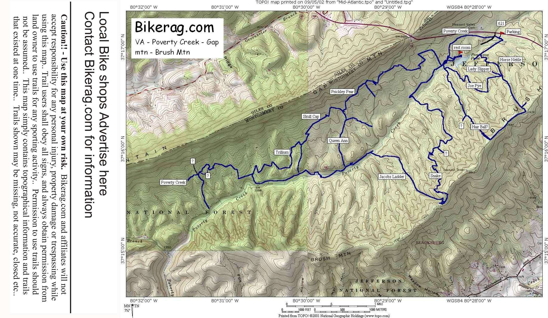
Directions - Just take 460 west past Blacksburg
and over brush mountain.. You will pass a sign indicating that you are
entering the Jefferson State forest.. Look for route 621 on
right, Take a LEFT into Pandapas Pond Park, immediate left into parking
lot..
|
Description - This is the local hotspot for Virginia Tech riders.. Great mountain biking spot that is well maintained and marked.. Quite a variety of trails here. The gap side is more technical and the brush mountain side has more elevation gain.. Gap side had some moderately technical trails that included small sporatic rock gardens, some log pyramids... One unmarked trail even had a nice 2 foot drop.. The brush side is all about descending or climbing.. Jacobs ladder was a nice uphill or downhill with log drop-offs.. Snake route was an awesome down with cool switchbacks, off camber single track leading to a banked turn section at the bottom.. Hairball would have been an awesome down, but we climbed it.. Horse nettle is the easiest gateway UP to the downhill's so of course we rode DOWN it.. Go here, ride all the trails, I almost guarantee it will be fun!! Yes I will come back to hit the trails I missed and revisit some others.. Visit East Coasters - local bike shop in Blacksburg on north main street.. They hooked us up with a new spoke, a map, suggested loop and some other hot spots to hit.. Pre-ride Music: Phish
- Rift |
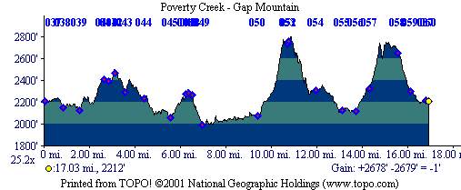
Total Miles: At Least 20, we managed to
ride 17 our first trip here |
Elevation Change Feet - 17 miles was 2700 ft -
Elevation
Profile |
| ||||||||||||||||||||||||||||||||||||||||||||||||||||||||||||||||||||


