|
|
|
|
| Topo Trail Map | Map Legend | Bikerag Pictures |


|
|
|
|
| Topo Trail Map | Map Legend | Bikerag Pictures |
|
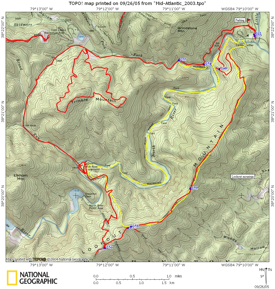
Lookout Mountain (Wild Oak trail) + Trimble mountain loop Mountain Bike Trail Review with Map and Pictures |
|||||||||||||||||||||||||||||||||||||||||||||||||||||||||||||||||||||||||||||
Directions - From Harrisonburg, take route 42
south to 747, to 730 (stokesville) to parking area for wild oak trail. |
Description - Not sure who this ride is for but NOT me. Trimble mountain loop was pretty cool, ride it clockwise, not a bad spin up nice off camber singletrack, then pretty nice rippin single down with a couple bumps.. Lookout climb was a fire road, which is fine, but once you get on the ridge you will be disappointed to see just a mild grassy singletrack.. Once you start the descent it turns into loose rocks, just nuisance moderate technical, not fun technical.. FINALLY near the bottom the trail turns GREAT for about 1/2 mile.. Really nice flow, good rock sections.. In my opinion the lookout ride was a waste of earned vert. Trimble was cool, but short 4 mile loop you can add on to the lookout ride or just do on its own for a rest day. Loops - Pre-ride Music: |
Total Miles: 19 miles if combined with
Trimble mountain looop |
|

|
Disclaimer: Caution - Use this map at your
own risk. Bikerag.com and affiliates will not accept
responsibility for an personal injury, property damage or trespassing while
using this map. Trail users shall obey all signs, and always obtain
permission from the land owner to use trails for any sporting activity.
Permission to use trails should not be assumed. This map simply
contains topographical information and trails that existed at one time.
Trails shown maybe be missing, not accurate, closed, overgrown etc.... |
To
view larger version of map, right click on map and select View Image. |
| ||||||||||||||||||||||||||||||||||||||||||||||||||||||||||||||||||||||