|
VA - Dragonsback - North Mountain - Mountain Bike Trail Review with Map and Pictures |
||||||||||||||||||||||||||||||||||||||||||||||||||||||||||||||||||||||||
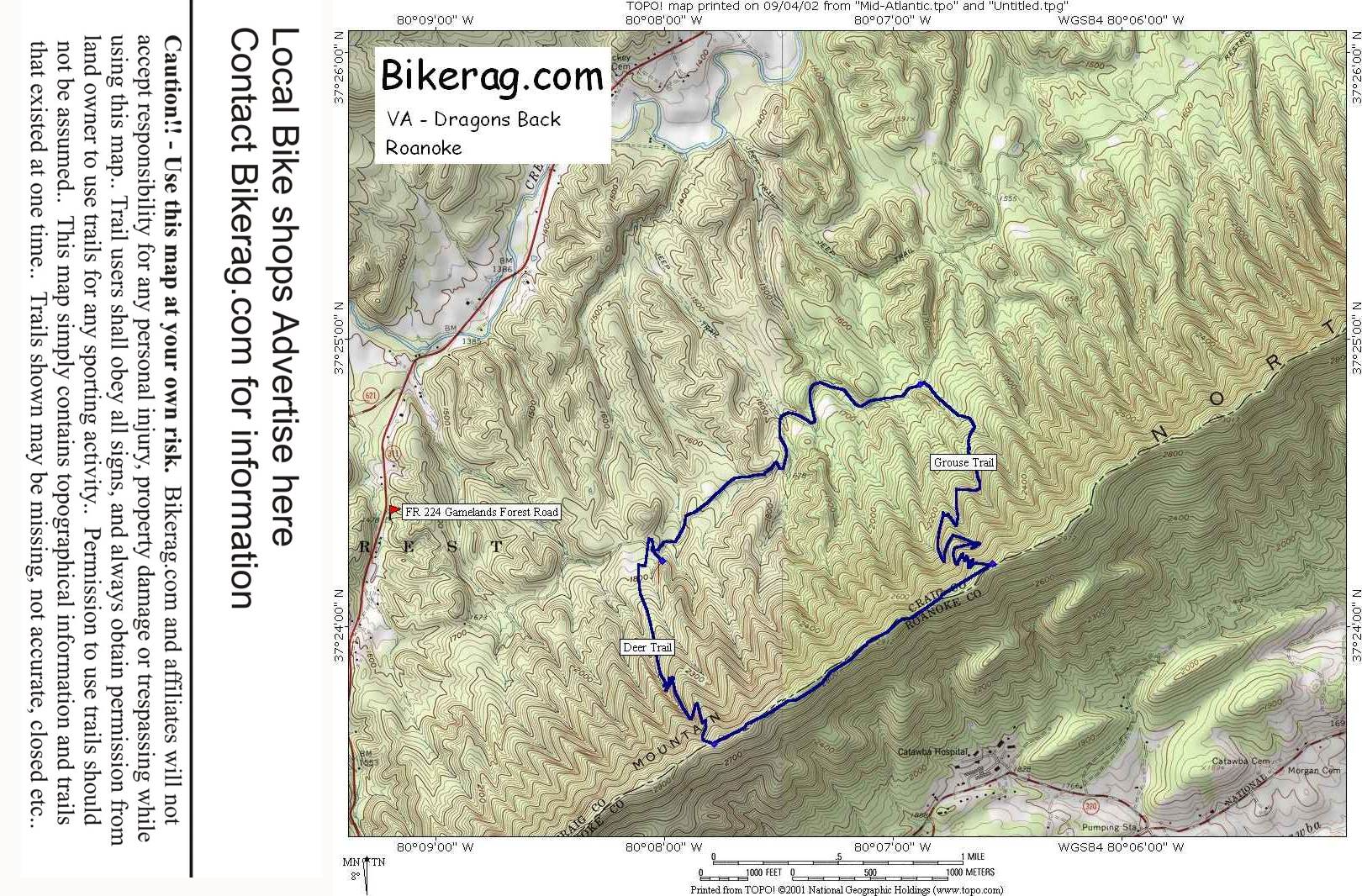
Directions - From Roanoke, take rte 311 north
and look for fr 224 (right turn) that is located about 2 miles after dragons
tooth parking area or craig county town line.. Follow 224 fire road
until you reach a trail on the right that is not clearly marked but has a
square pole at the exit. Park here, Follow the fire road for about 2
miles and look for the grouse trail that is well marked.. Take a right
and follow it for 2 miles straight up. From the top take a right on
the ridge, follow for about 1.2 miles and take a right onto deer trail
marked with stone pile at base of tree.. Just ride back to the car on
this trail.. |
Description - Nothing much too see here, WHAT a disappointment!! Technical my ass, its just a freakin climb up tons of mostly un-rideable (by most) switchbacks.. The trail between switchbacks is straight, off camber and easy.. Just up.. Once at the top the trail is pretty good, fun rocks, good singletrack, but before you know it, its over and you have to DESCEND down the deer trail.. Nothing like a wasted 1700 vertical climb eh?? TOtally lame downhill, kind of fun in parts but besides switchbacks there is no terrain, just straight off camber trail.. OK, I confess, I have not ridden all the trails here.. Im sure the turkey trail is better, just couldn't suffer the boredom of another trip up grouse trail.. Please tell me if im grousely wrong here.. Keep in mind if you do the turkey trail, add like 4 miles of suk-ass fire road to the end of your trip.. Lots of wildlife to see here - we saw tons of deer, turkeys, grouses, and a lizard. Just a note, this ride is a great workout.. So if that's what your after, do some laps, just don't plan on enjoying yourself unless you find a monkey to strangle in the woods.. PS - People from VA seem to love this ride, so if your from VA I assume youll like it too. PSS - Good gonzo switchback practice, if that kind of thing turns you on.. Visit Eastcoasters.com for a map, or drop by their shop in Roanoke or Blacksburg Pre-ride Music: Once
again, Praga Khan - Wasting my time |
Total Miles: 6.5 for the short loop |
Elevation Change Feet -
1700 feet in 6.5 miles - ouch |
| ||||||||||||||||||||||||||||||||||||||||||||||||||||||||||||||||||||


