|
|
|
|
| Topo Trail Map | Map Legend | Bikerag Pictures |


|
|
|
|
| Topo Trail Map | Map Legend | Bikerag Pictures |
|
Needles - Elephant hill to confluence overlook - Mountain Bike Trail Review with Map and Pictures |
|||||||||||||||||||||||||||||||||||||||||||||||||||||||||||||||||||||||||||||
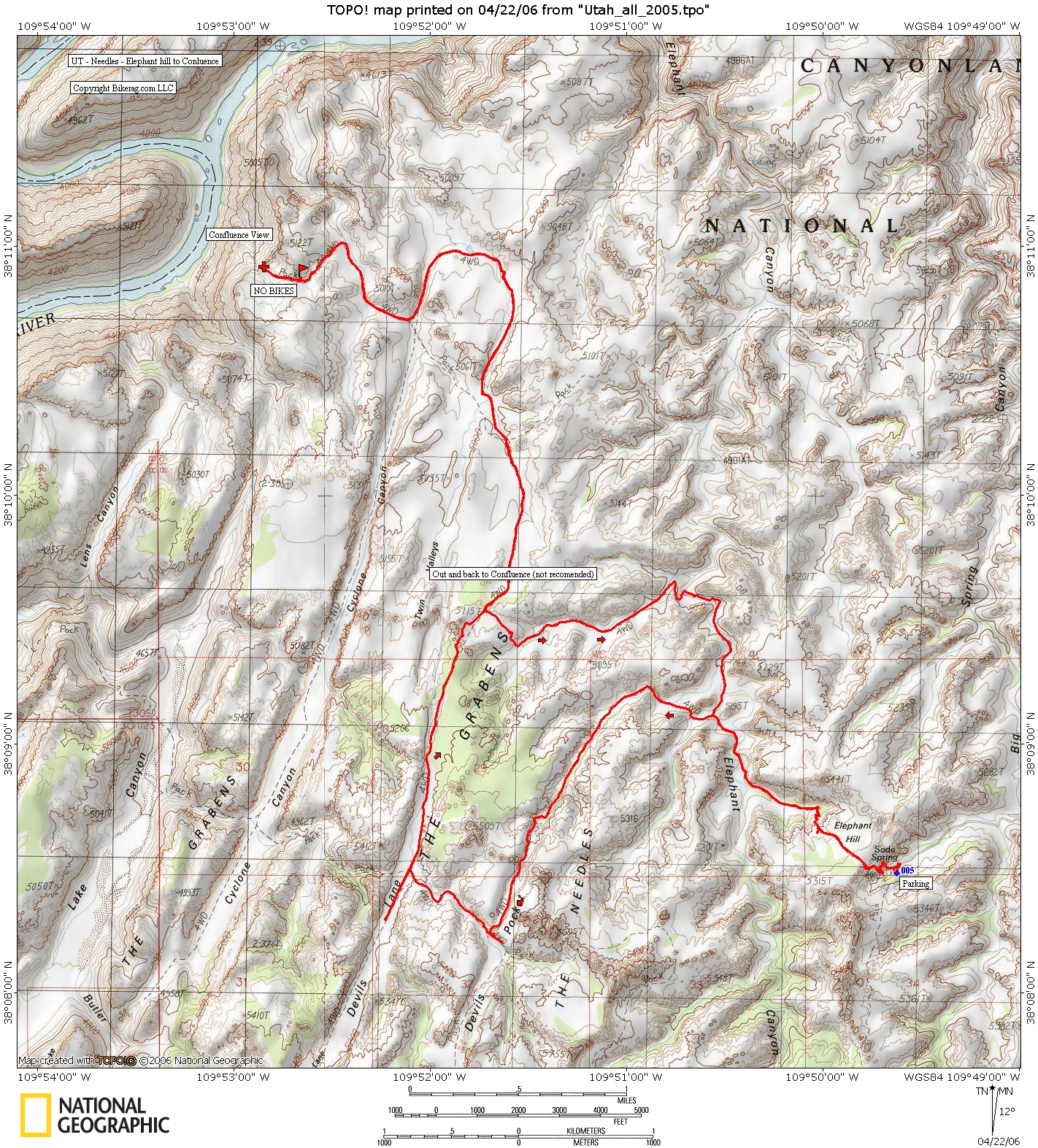
Directions - About 1.25 hours from moab.
Take 191 south for about 36 miles to 211, right turn, another 30 miles past
newspaper rock, pay FEE for canyon lands, go past visitors center and follow
signs for elephant hill. Bathrooms at parking lot, and midpoint and
endpoint of ride.. Water fountains in visitor center, bring lots of
water.. |
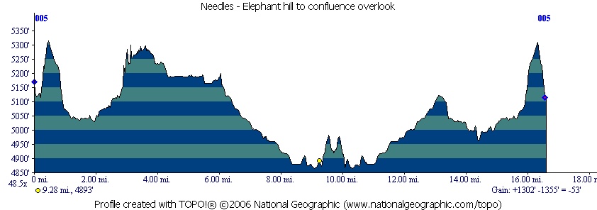
Description - This is an odd but decent ride, a mix of mild plus technical steep rock, roads with sand and views. 80% or so of the trail is just sandy road, during our trip it was 99% rideable, but im sure conditions vary with weather and vehicle traffic. Many family jeepers use this area, the start was total kiddie mayhem at the parking lot, but quick climb up elephant hill led to peace and quite.. Steep rock was totally rideable up and down.. Granny one up for sure.. The sand road through the shallow valley was very cool with rock formations and foliage. View from devils kitchen was amazing.. DONT waste your time with the out and back to confluence like we did.. 3 mile out and back through moderate to light sand, PLUS a 1/2 mile WALK with your bike to view littered with people.. Think if you skip the out and back, this ride is a decent rest day ride, if your lookin for something new, scenic ride, not too jarring.. Be warned about the crowds and sand.. Loops - Pre-ride Music: |
Total Miles: 17 if you go out and back to
confluence overlook, 11 as nice lariat |
Elevation Change Feet -1300 ft This is a pretty flat ride with the
steepest climbs |
|
Disclaimer: Caution - Use this map at your
own risk. Bikerag.com and affiliates will not accept
responsibility for an personal injury, property damage or trespassing while
using this map. Trail users shall obey all signs, and always obtain
permission from the land owner to use trails for any sporting activity.
Permission to use trails should not be assumed. This map simply
contains topographical information and trails that existed at one time.
Trails shown maybe be missing, not accurate, closed, overgrown etc.... |
To
view larger version of map, right click on map and select View Image. |
| ||||||||||||||||||||||||||||||||||||||||||||||||||||||||||||||||||||||