|
|
|
|
| Topo Trail Map | Map Legend |


|
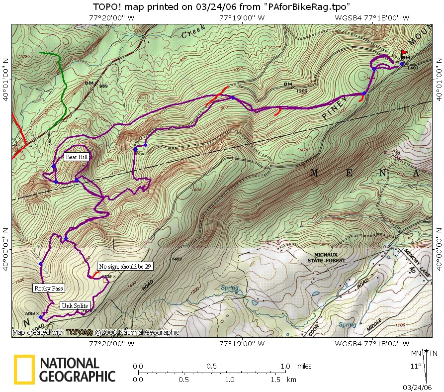
PA - Rocky Pass - Michaux atv - Mountain Bike Trail Review with Map and Pictures - Thanks Jack!! |
|||||||||||||||||||||||||||||||||||||||||||||||||||||||||||||||||||||||||||||
|
Michaux ATV.  NOTE:  map should be used along with ATV map provided by the
forest service.  The waypoint numbers were chosen to correspond to the ATV
map intersection numbers.  The numbers mark intersections, NOT trail
numbers.  Not as great as the other trails in the area, but if you've got
time it will challenge you.

Here's the route we took, which was not well planned.  Take SE233 to
Bendersville Road just South of Pine Grove Furnace.  Follow Bendersville to
the Piney Mountain Parking Lot and park there.  From the lot's NW corner
take Log Sled Trail.  R at 44 goes back to parking lot.  L 36, R 34, R 33
(staley alley), we rode CCW around Bear Hill, but CW would have been more
fun.  Back out Staley towards 28, L at 28 (tough climb).  Keep climbing past
Fender Trail and begin to parallel the road.  Use your best sense to
parallel the road ignoring side abandoned ATV trails and cut-throughs.  Then
R at 24 and begin the Rocky Pass downhill.  R at 27, L at 28.  Then we had
to bail onto Log Sled Trail back to the parking lot due to darkness.
Loops - Pre-ride Music: |
Total Miles: 12 for our loop which
included a couple of short excursions to |
nowhere. Many more miles available.
Elevation Change Feet - |
|
Disclaimer: Caution - Use this map at your
own risk. Bikerag.com and affiliates will not accept
responsibility for an personal injury, property damage or trespassing while
using this map. Trail users shall obey all signs, and always obtain
permission from the land owner to use trails for any sporting activity.
Permission to use trails should not be assumed. This map simply
contains topographical information and trails that existed at one time.
Trails shown maybe be missing, not accurate, closed, overgrown etc.... |
To
view larger version of map, right click on map and select View Image. |
| ||||||||||||||||||||||||||||||||||||||||||||||||||||||||||||||||||||||