|
|
|
|
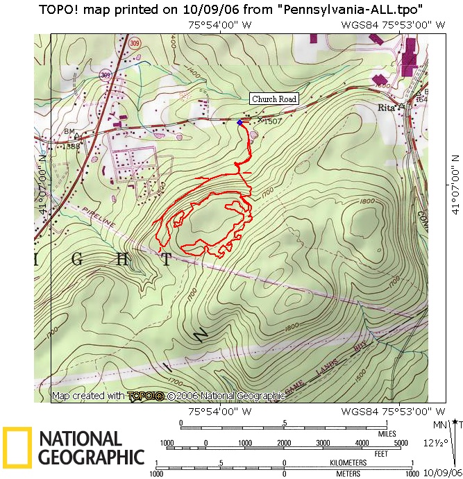
| Church Road Trail Map | Map Legend |


|
PA - Church Road - Mountain Top area - Mountain Bike Trail Review with Map and Pictures - Preliminary Review |
||||||||||||||||||||||||||||||||||||||||||||||||||||
|
||||||||||||||||||||||||||||||||||||||||||||||||||||
| Directions - I 81 to exit 165, route 309
south for about 8ish miles, look for left on church road after St Judes.
GO down road for about .7 miles and look for parking area on right. Description - Got some background on this place from a fellow rider I met at seven tubs and from a local in the parking lot.. All of the trails in the area were put in by mountain bikers with the permission of the state. Right now building is on hold. All trails are singletrack and are highly maintained. The trail surface is the equivalent of baby heads and babys feet, no smooth parts.. The trail was laid out perfectly, but the surface kind of kills your flow.. The DH sections were of course great. Really nice forest with a couple notable sections like the Gynecologic exam trail features, and the rock garden pathway.. My lower back couldn't hold up for more than 4 miles of this trail, otherwise would have checked out the rest.. The only real downer of this system was that it lacked variety or character, but still a good local spin. Loops - |
||||||||||||||||||||||||||||||||||||||||||||||||||||
| Pre-ride Music: | ||||||||||||||||||||||||||||||||||||||||||||||||||||
| Total Miles: | ||||||||||||||||||||||||||||||||||||||||||||||||||||
| Elevation Change Feet - | ||||||||||||||||||||||||||||||||||||||||||||||||||||
|
||||||||||||||||||||||||||||||||||||||||||||||||||||
| Disclaimer: Caution - Use this map at your own risk. Bikerag.com and affiliates will not accept responsibility for an personal injury, property damage or trespassing while using this map. Trail users shall obey all signs, and always obtain permission from the land owner to use trails for any sporting activity. Permission to use trails should not be assumed. This map simply contains topographical information and trails that existed at one time. Trails shown maybe be missing, not accurate, closed, overgrown etc.... | ||||||||||||||||||||||||||||||||||||||||||||||||||||
| To
view larger version of map, right click on map and select View Image.
|
||||||||||||||||||||||||||||||||||||||||||||||||||||