|
|
|
|
|
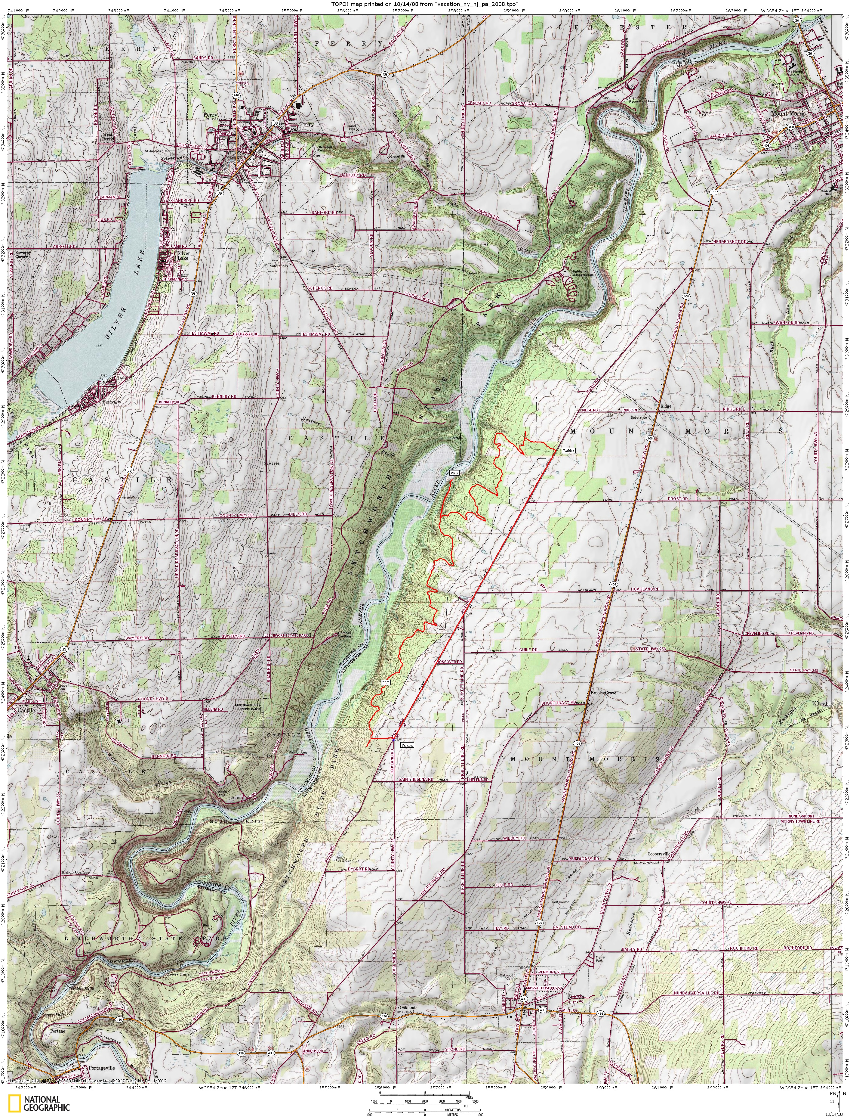
Letchworth Trail Map Link Trail map (short section we rode) |
Map Legend |


|
|
|
|
|
Letchworth Trail Map Link Trail map (short section we rode) |
Map Legend |
|
Letchworth State Park, Castile NY - Mountain Bike Trail Review with Map and Pictures
Very Preliminary Review - 25% - Just one ride |
||||||||||||||||||||||||||||||||||||||||||||||||||||
|
||||||||||||||||||||||||||||||||||||||||||||||||||||
| " The Grand Canyon of the East" Local website for the latest info: http://www.wnymba.org/ + www.victormtbc.com + http://nysparks.state.ny.us/parks/info.asp?parkID=12 Directions - Fore directions to the trail, it really depends on which section you are riding. The longest trail that is open to mountain bikes is the finger lakes trail which can be accessed by several parking areas on river road or the mount morris dam entrance. For the section we rode, take 390 to 408 west into town. Do not follow signs for letchworth unless your here to sight see, or ride the few trails that are open on the west side of the river. From 408 look for a right on River road. Several parking areas on river road Description - First of all, not all of the trails at letchworth are open to bikes. At the time of our visit the map from the park ranger indicated the following trails are open (2, 2a, 3, 58, 8a, 10, 11, 13, FLT, 19) - Partialy open are trails 7,18,20. You need to register to ride the FLT and it is one of the few sections of FLT that have been made available for bikes, so tread lightly and absolutely do not ride when wet. The section of trail we rode (see map below) was mainly singletrack and pretty buff, but not super buff. No rocks to speak of, but some logs and at the time of our visit some leftover debris from the hurricane. The only technicalities to speak of are the various arrangements of the stream crossings or gully's.. Everything flows great until you get to the gully's and then about 1/2 the time you may need to get off your bike for a short hike a bike.. The forest is really scenic, but you wont see the gonzo crazy grand canyon scenery unless you take a spur trail to the view. After the ride we had time to head into the park for a fee of like $6.00 (well worth it), the scenery is nothing short of amazing. Waterfalls were so awesome we decided not to bother going to niagra falls. Fall scenery wasn't quite peak, but still blew us away. I would go back here in a heartbeat to check out the other sections of the FLT and the other trails open to bikes.. Lots of miles of trail here, great for all day rides, epic adventures or group rides. Just don't go here expecting too much of a technical challenge. Loops - We rode a section of the FLT and took road back. 12 mile loop (clockwise), road ride was pretty flat and scenic 2-boot. One out and back to a nice view. |
||||||||||||||||||||||||||||||||||||||||||||||||||||
| Pre-ride Music: | ||||||||||||||||||||||||||||||||||||||||||||||||||||
| Total Miles: 40ish? | ||||||||||||||||||||||||||||||||||||||||||||||||||||
| Elevation Change Feet - | ||||||||||||||||||||||||||||||||||||||||||||||||||||
|
||||||||||||||||||||||||||||||||||||||||||||||||||||
| Disclaimer: Caution - Use this map at your own risk. Bikerag.com and affiliates will not accept responsibility for an personal injury, property damage or trespassing while using this map. Trail users shall obey all signs, and always obtain permission from the land owner to use trails for any sporting activity. Permission to use trails should not be assumed. This map simply contains topographical information and trails that existed at one time. Trails shown maybe be missing, not accurate, closed, overgrown etc.... | ||||||||||||||||||||||||||||||||||||||||||||||||||||
| To
view larger version of map, right click on map and select View Image.
|
||||||||||||||||||||||||||||||||||||||||||||||||||||