|
Nova Scotia - Whopper Dropper & Bustin Out - Mountain Bike Trail Review with Map and Pictures |
||||||||||||||||||||||||||||||||||||||||||||||||||||||||||||||||||||||||||||||
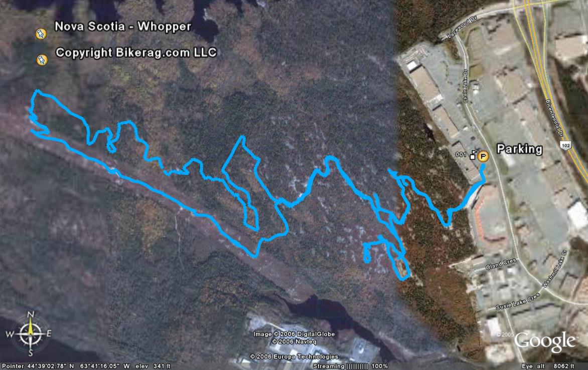
Directions - Its easy - Go to bayers lake
industrial park, route 102 to exit 2a.. Just look for burger
king and park in one of the strip mall lots nearby.. Trailhead is off
the gravel road right behind burger king, hence the name whopper dropper.. |
Description - Whopper dropper is so focking cool, slick rock right out of the gate, one offshoot playground.. Lots of small drops and stuff to play on... Then you get to the power lines, might find some stunts there, follow until you see a trail on right that goes up a cool rocky singletrack, to granite knife edge, this trail is Bustin out.. Super technical rocky singletrack, with an epic over under sky bridge.. Some sick lines, very technical.. On your way back home, you may find a new singletrack on your left, marked something new on Randy Grays map, its another cool section that will lead you back to the whopper dropper trail.. This ride reminded me of goldbar rim in moab, minus the rim.. For a map, just go to any local bike shop and pic up Randy Gray's Mountain Bike trail Book.. Its like 3.50$ american, well worth it.. I will have a map up at some point but lack Nova Scotia Topo software.. Pre-ride Music: |
Total Miles: 8 |
Elevation Change Feet - Flat |
|
Disclaimer: Caution - Use this map at your
own risk. Bikerag.com and affiliates will not accept
responsibility for an personal injury, property damage or trespassing while
using this map. Trail users shall obey all signs, and always obtain
permission from the land owner to use trails for any sporting activity.
Permission to use trails should not be assumed. This map simply
contains topographical information and trails that existed at one time.
Trails shown maybe be missing, not accurate, closed, overgrown etc.... |
To
view larger version of map, right click on map and select View Image. |
|
| ||||||||||||||||||||||||||||||||||||||||||||||||||||||||||||||||||||||


