|
|
|
|
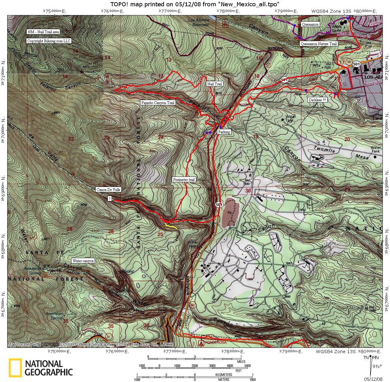
| Trail map | Map Legend |


|
Nail Trail - Pajarito canyon - Reverse Traverse - Canon
de valle - Water canyon - Los Alamos, NM - Mountain Bike Trail Review with Map and Pictures
Preliminary Review - One ride |
||||||||||||||||||||||||||||||||||||||||||||||||||||
|
||||||||||||||||||||||||||||||||||||||||||||||||||||
| Directions - This ride is just outside of
town. Take 501 and look for trailhead on right - just past road
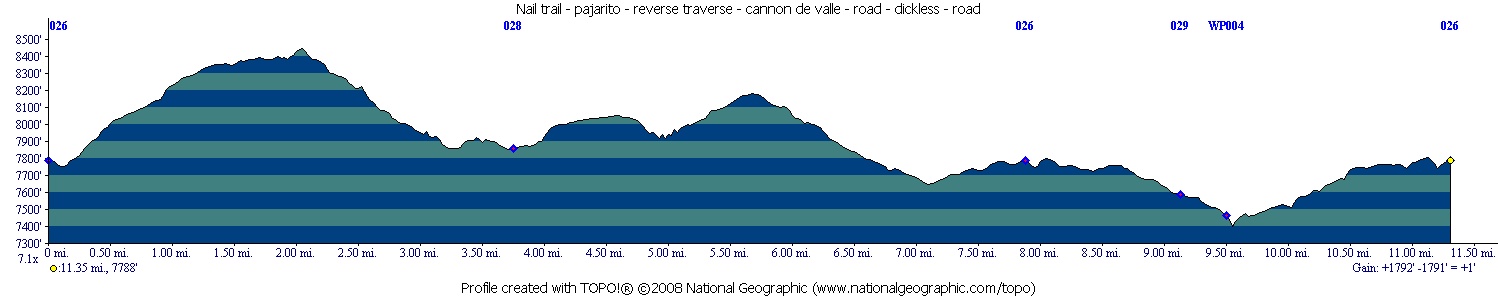
to Pajarito Mountain ski area. Description - The initial climb up nail trail was technical, up some slab rocks similar to quemazon uphilling, but more loose stuff. The trail mellows out a bit and gently climbs to top of pajarito canyon trail on some wider trails and eventually singletrack. Found one cool log ride on the way up - Always bonus points for that.. Pajarito canyon was very cool bench cut singletrack (lean to the left style), with some nice views and tranquil stream. The trail even passes a nice rock climbing area. Nothing too technical, but really nice flow, and good scenery. From here we took the first singletrack right that is the perimeter trail or "reverse traverse" that was nice singletrack through open woods, turning into dirt road singletrack eventually that buzzed downhill to the Canon De Valle trail. We went up and back on canon de valle, turning around when the trail turned muddy (rode this in the spring).. Not sure what the rest of the trail was like but it was pretty mello singeltrack with some loose pea gravel in spots. Just one or 2 tech sections. We missed water canyon, but I hear its good stuff, similar to pajarito canyon downhill, only longer and with a nice log ride! Dammit Jim.. Took some road back and ventured out on dickless which was a well used trail that connects LANL to Nail trail. Looks like many lunch rides happen in los alamos, which is great. I wouldnt bother using Dickless unless you have to, its basically a "get you there" trail, wish I picked water canyon instead. Next time.. Next time.. Loops - |
||||||||||||||||||||||||||||||||||||||||||||||||||||
| Pre-ride Music: | ||||||||||||||||||||||||||||||||||||||||||||||||||||
| Total Miles: 20 ish in area?? | ||||||||||||||||||||||||||||||||||||||||||||||||||||
|
Elevation Change Feet - 1800
|
||||||||||||||||||||||||||||||||||||||||||||||||||||
|
||||||||||||||||||||||||||||||||||||||||||||||||||||
| Disclaimer: Caution - Use this map at your own risk. Bikerag.com and affiliates will not accept responsibility for an personal injury, property damage or trespassing while using this map. Trail users shall obey all signs, and always obtain permission from the land owner to use trails for any sporting activity. Permission to use trails should not be assumed. This map simply contains topographical information and trails that existed at one time. Trails shown maybe be missing, not accurate, closed, overgrown etc.... | ||||||||||||||||||||||||||||||||||||||||||||||||||||
| To
view larger version of map, right click on map and select View Image.
|
||||||||||||||||||||||||||||||||||||||||||||||||||||