|
|
|
|
| Topo Trail Map | Map Legend | Bikerag Pictures |
|
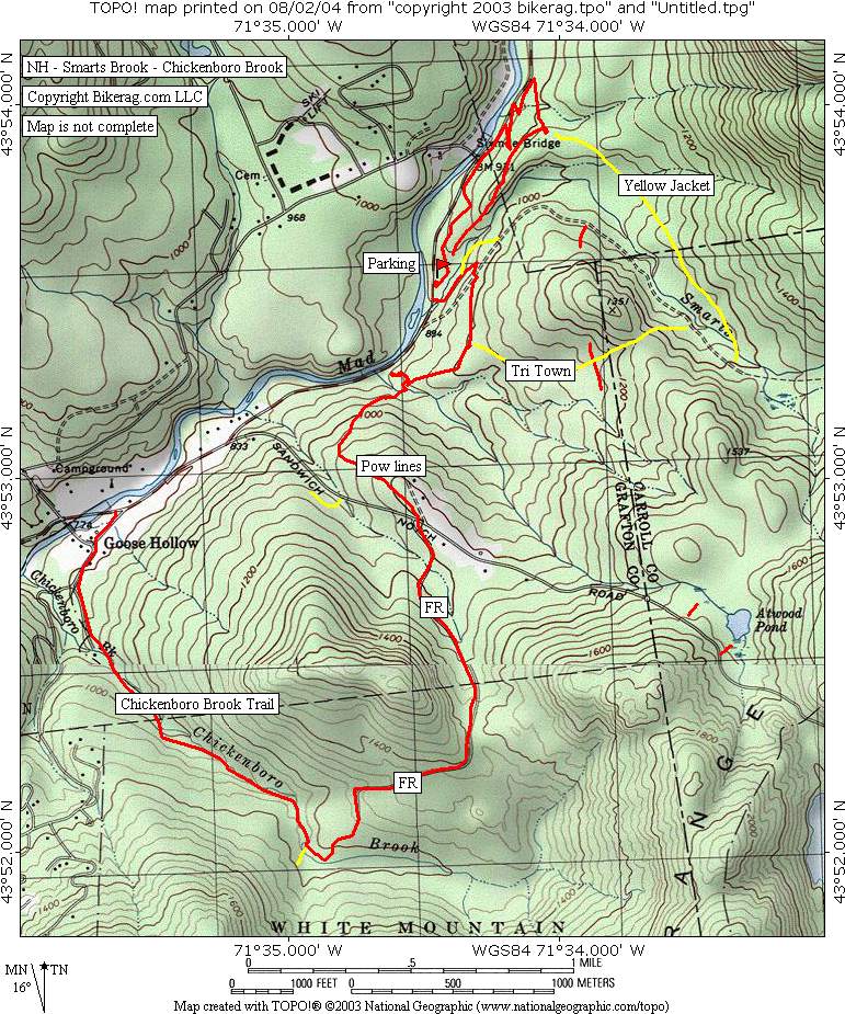
NH - Smart's Brook - Chickenboro Brook - Mountain Bike Trail Review with Map and Picture |
|||||||||||||||||||||||||||||||||||||||||||||||||||||||||||||||||||||||||||||
Directions - 93 north to exit
28-Waterville Valley-Campton-Thornton, route 49 east for 5.1 miles, parking
area is on right, fee is $3.00 as of 2004. |
Description - Nothing too crazy here, some rooty double track, short sections of single track, really cool scenery if you like flowing water.. Not very technical, but pretty hilly.. The actual smarts brook trail we took was fire road, but it may be more of a trail if taken further south.. Tri town was decent.. Nothing that really inspired me here, but still a decent place to spin if your in the area.. Anyone know of better trails around here that I missed?? Atwood ski trail any good?? I was thining of trying smarts brook trail all the way to algonquin trail, back to bear notch road?? Is that legal?? Loops - Take smarts brook (trail for 50 ft, then dirt road) to yellow jacket, back to car, then take dirt road again, but rake a right on tri town, left on unmarked singletrack, left at Y, left up power lines, cross road past gate on poor mans singletrack, up, then down, waste of vert, turns to single for a bit, then follows chickenboro brook , back to road, pedal up 49 all uphill to the car, just how you like it.. Pre-ride Music: |
Total Miles: 10+ |
Elevation Change Feet - Elevation
Profile |
|
Disclaimer: Caution - Use this map at your
own risk. Bikerag.com and affiliates will not accept
responsibility for an personal injury, property damage or trespassing while
using this map. Trail users shall obey all signs, and always obtain
permission from the land owner to use trails for any sporting activity.
Permission to use trails should not be assumed. This map simply
contains topographical information and trails that existed at one time.
Trails shown maybe be missing, not accurate, closed, overgrown etc.... |
To
view larger version of map, right click on map and select View Image. |
| ||||||||||||||||||||||||||||||||||||||||||||||||||||||||||||||||||||||