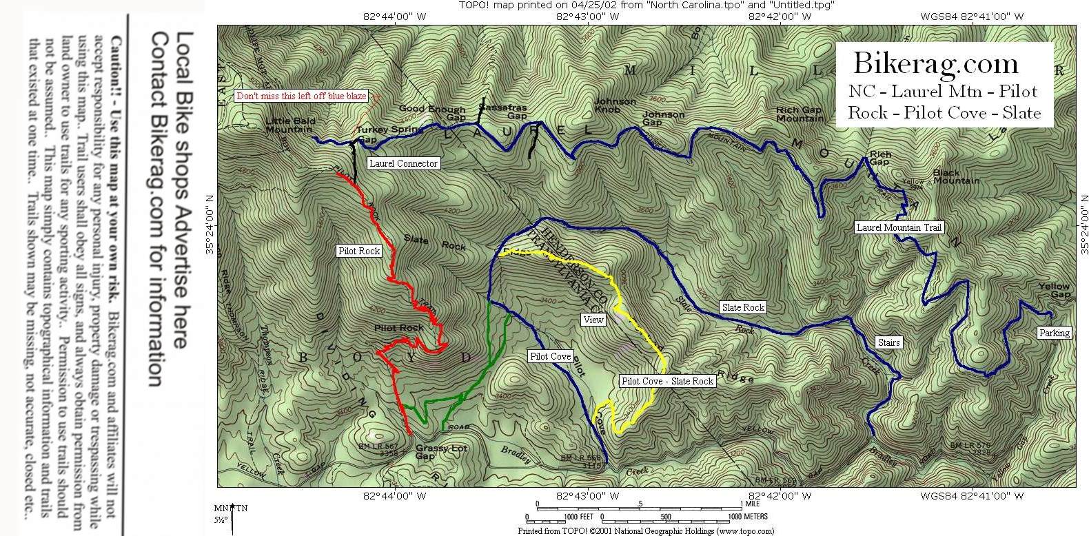
| Directions - Follow directions for Laurel mtn,
go past laurel mtn trailhead several miles and look for pilot cove
trailhead. Description - Category - Intermediate
(although beginners would just die) - This is the climb from hell
Start at 1206, pilot cove trailhead and look for right turn on yellow
blazed trail up short stairs (Pilot cove - slate rock trail).. You
take this trail up, all rideable, forever! Every time you think your at the top, your
not.. A couple of short downhills will trick you every time.. A
very balancy granny 1 or 2 climb through roots, some rocks, some
switchbacks.. On the way up you will pass right by scenic Slate rock
where you have views of pilot rock, pilot rock ridge and surrounding
mountains.. When you finally get to the end of the yellow, you hit a T
at the pilot rock trail. Take a left and go steeply downhill. 2
good techs for the first part of the descent, one small rock channel to ride
through, then a pretty big behind the seat roller.. Trail turns to
less steep fun winding single track with nice jumps over water some water
bars. 3 bridges you hit on the way down are pretty cool. First
sleazy double log, second wheelie up to triple log ride, then drop off back
to trail third is a reall sleazy flat ramp you can fly off and get 6" of
safe air (at speed).. Back to the car (this loop took us an hour
(after riding the laurel loop) with some OOO AHH and lots of sweat)..
Easy now!!
|


