|
|
|
|
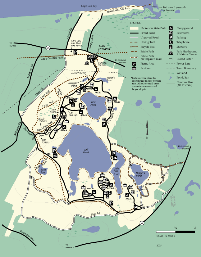
| Nickerson state Park Trail map | Map Legend |


|
Nickerson State Park - Brewster - Mountain Bike Cape Cod - Trail Review with Map and Pictures
|
||||||||||||||||||||||||||||||||||||||||||||||||||||
|
||||||||||||||||||||||||||||||||||||||||||||||||||||
| Directions - Its right off Rt 6A in Brewster. Description - FINALLY after all the time we have spent at the cape, hit up Nickerson for not ONE but TWO days of riding. I had very low expectations, figured it was mainly rail trail plus some doubletrack. Actually found some decent singletrack, some even technical and fun. The trails around cliff pond and little cliff ponds had some challenging sections. Some sand too, but almost all rideable. On bikerag map - Trails in red / purple are generally singletrack or lead you to singletrack. Yellow dashed is unexplored but assume its trail. Loops - |
||||||||||||||||||||||||||||||||||||||||||||||||||||
| Pre-ride Music: Urbs - The Incident | ||||||||||||||||||||||||||||||||||||||||||||||||||||
| Total Miles: At least 10 miles of singletrack, more to explore | ||||||||||||||||||||||||||||||||||||||||||||||||||||
| Elevation Change Feet - | ||||||||||||||||||||||||||||||||||||||||||||||||||||
|
||||||||||||||||||||||||||||||||||||||||||||||||||||
| Disclaimer: Caution - Use this map at your own risk. Bikerag.com and affiliates will not accept responsibility for an personal injury, property damage or trespassing while using this map. Trail users shall obey all signs, and always obtain permission from the land owner to use trails for any sporting activity. Permission to use trails should not be assumed. This map simply contains topographical information and trails that existed at one time. Trails shown maybe be missing, not accurate, closed, overgrown etc.... | ||||||||||||||||||||||||||||||||||||||||||||||||||||
| To
view larger version of map, right click on map and select View Image.
|
||||||||||||||||||||||||||||||||||||||||||||||||||||


