|
|
|
|
| Topo Trail Map | Map Legend | Bikerag Pictures |
|
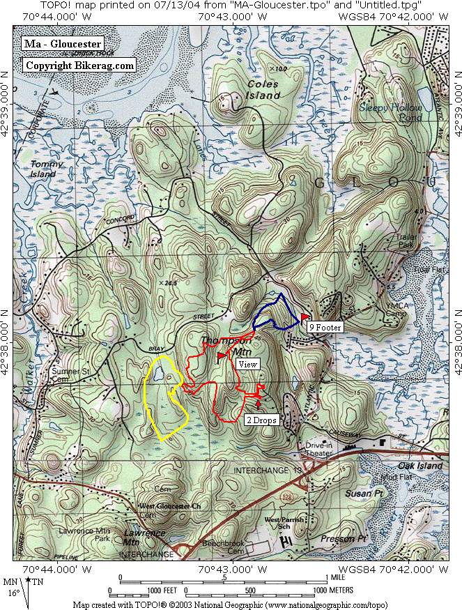
MA - Dogtown - Gloucester - Mountain Bike Trail Review with Map and Pictures Preliminary Review.. |
||||||||||||||||||||||||||||||||||||||||||||||||||||
Review by Crash & Burn - Thanks Buckets man - Great Job!! |
||||||||||||||||||||||||||||||||||||||||||||||||||||
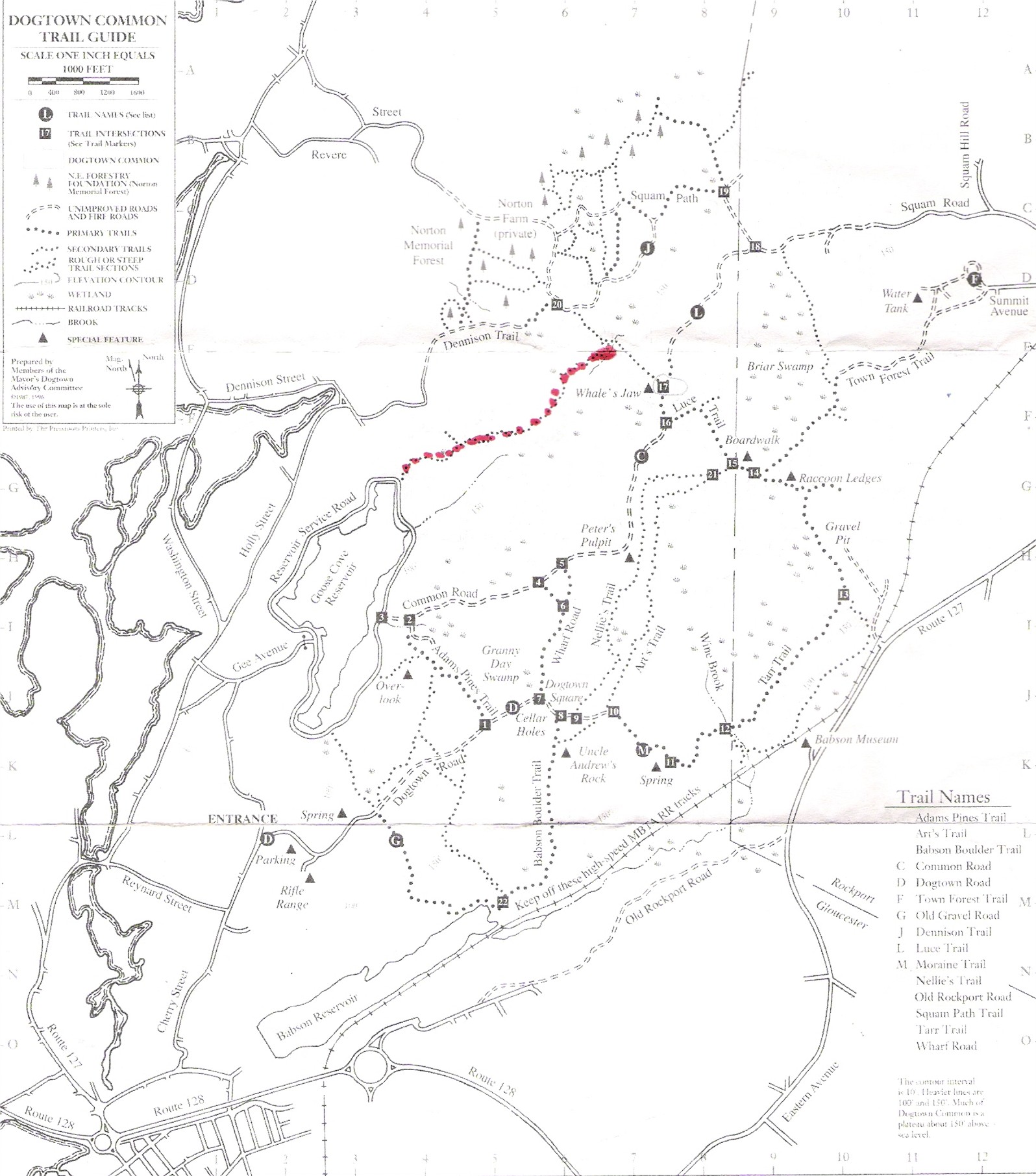
| Directions - From Boston take 93 North to
95/128 North, follow 128 North at the split towards Peabody. The more
popular area I rode can be accessed from either exit 13 or 14 in West
Gloucester. The local riders that were nice enough to give me the tour asked
that a parking area not be labeled because much of it is on private
property, but just look at the map and figure it out. Description - From
what I was told there is over 30 miles of trails in the area, most of which
is windy, up-and-down single track. You can ride trails all the way along
Rte 128 as far south as exit 18 for a real epic day. This tucked away spot
has lots to offer in a small area. The trails are tight and technical and
the more popular section, known as Bruce and Tom’s excellent adventure, has
several ramps, bridges and drops, as well as infinite natural obstacles.
There’s also a nice view of the north shore from atop a cool slickrock
section. This is a great ride for a fall day. Although there is not much
elevation change, your legs will work hard through these narrow tree lined
trails. There is lots more land out here and the locals are sure to be
adding continually to this trail network. The main loops are labeled red,
yellow and blue, but there are many more trails around that could make it
easy to get confused. I stuck to the main trails because they have the
stunts, but there are several days of riding out here if you have the time
to explore. |
||||||||||||||||||||||||||||||||||||||||||||||||||||
| Pre-ride Music: | ||||||||||||||||||||||||||||||||||||||||||||||||||||
| Total Miles: | ||||||||||||||||||||||||||||||||||||||||||||||||||||
| Elevation Change Feet - Elevation Profile - | ||||||||||||||||||||||||||||||||||||||||||||||||||||
|
||||||||||||||||||||||||||||||||||||||||||||||||||||
| Disclaimer: Caution - Use this map at your own risk. Bikerag.com and affiliates will not accept responsibility for an personal injury, property damage or trespassing while using this map. Trail users shall obey all signs, and always obtain permission from the land owner to use trails for any sporting activity. Permission to use trails should not be assumed. This map simply contains topographical information and trails that existed at one time. Trails shown maybe be missing, not accurate, closed, overgrown etc.... | ||||||||||||||||||||||||||||||||||||||||||||||||||||
| To
view larger version of map, right click on map and select View Image.
|
||||||||||||||||||||||||||||||||||||||||||||||||||||


