


|
MA - Foxboro- Mountain Bike Trail Review with Map and Pictures |
||||||||||||||||||||||||||||||||||||||||||||||||||||||||||||||||||||||||
 |
||||||||||||||||||||||||||||||||||||||||||||||||||||||||||||||||||||||||
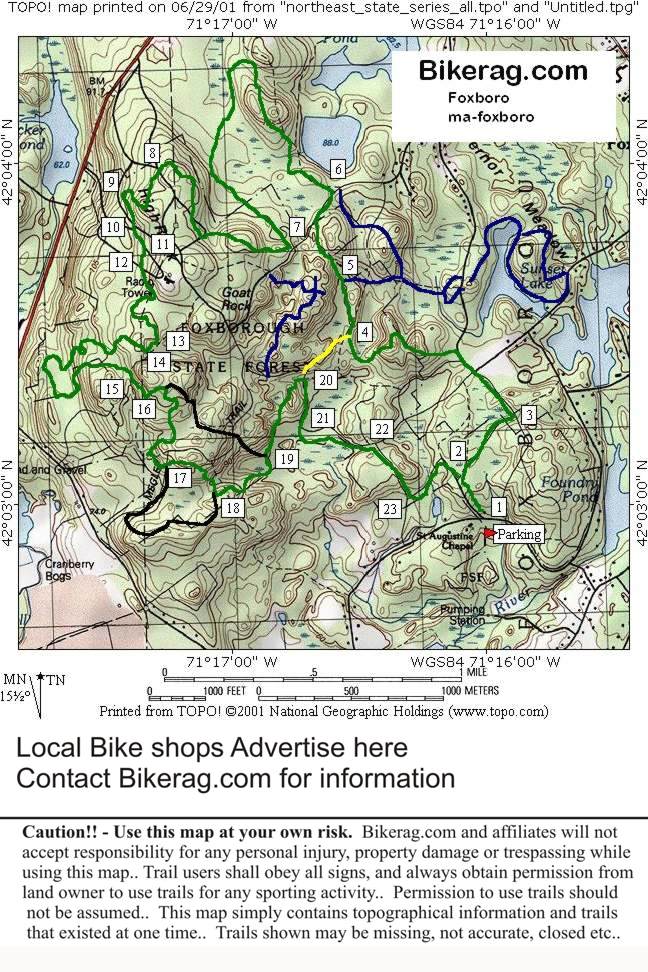
Directions - take 495 north or south to rte
95 north.. Take exit 7 rte 140 north to Foxboro center, go almost all the
way around square rotary its like the 6th right out of the rotary, the next
right would shoot you back from where you came from (not the womb, but
rte 140), anyway take this road for 1.42 miles and take a left (sign
for f-Gilbert hills state park) and travel a short distance, parking lot is
across fire station., there are trail maps at the fire station
adjacent trailhead.. |
Description - Lots of trails here - semi rocky single track, some fire roads, with a few slick rock sections and nemesis technicalities. Similar to case mountain in CT, except, completely different. Pre-ride Music:
Hendrix - foxy lady |
Total Miles: 20 - ish |
Elevation Change Feet - Elevation
Profile - |
|
| |||||||||||||||||||||||||||||||||||||||||||||||||||||||||||||||||||


