|
|
|
|
| Topo Trail Map | Map Legend | Bikerag Pictures |


|
CT - Crescent Lake - Mountain Bike Trail Review with Map and Pictures |
|||||||||||||||||||||||||||||||||||||||||||||||||||||||||||||||||||||||||||||
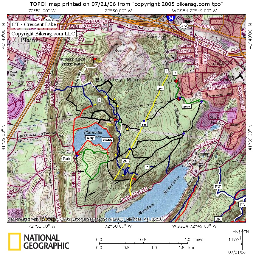
Directions - From 84, take exit 32, route 10,
queen street south, for about 1 mile, take a left onto Flanders STREET, 1.44
miles take left on flanders ROAD, .59 miles take right on mine hollow road,
.98 miles take left on shuttle meadow road, .75 miles park on right.
Be aware of the parks hours, they may lock the gate at night.. |
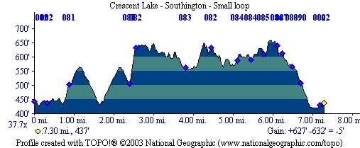
Description - The trails start out safely enough with some buff double, then some slightly rocky stuff on the green loop, good warm-up.. Then there's a pretty killer climb, up loose boney rocks on a fire road, a good make.. Now the fun stuff the blue trail had some great lines, technical, fair amount of slickrock, and nice drops and rollers all over.. Its kind of hard to get a good loop in but after we check the place out more, I'm sure it will be better.. Some hike a bike is required here and there, but not to painful, totally worth it in my opinion.. Great ride.. BEWARE - GATE CLOSES AT 8:00!!!! They WILL lock your car in!!! Loops - Check back, working on loop Pre-ride Music: |
Total Miles: 10 +/- |
|
|
 Disclaimer: Caution - Use this map at your
own risk. Bikerag.com and affiliates will not accept
responsibility for an personal injury, property damage or trespassing while
using this map. Trail users shall obey all signs, and always obtain
permission from the land owner to use trails for any sporting activity.
Permission to use trails should not be assumed. This map simply
contains topographical information and trails that existed at one time.
Trails shown maybe be missing, not accurate, closed, overgrown etc.... |
|
 | ||||||||||||||||||||||||||||||||||||||||||||||||||||||||||||||||||||||


