|
AZ - Huckaby - Mountain Bike Trail Review with Map and Pictures
|
|
|
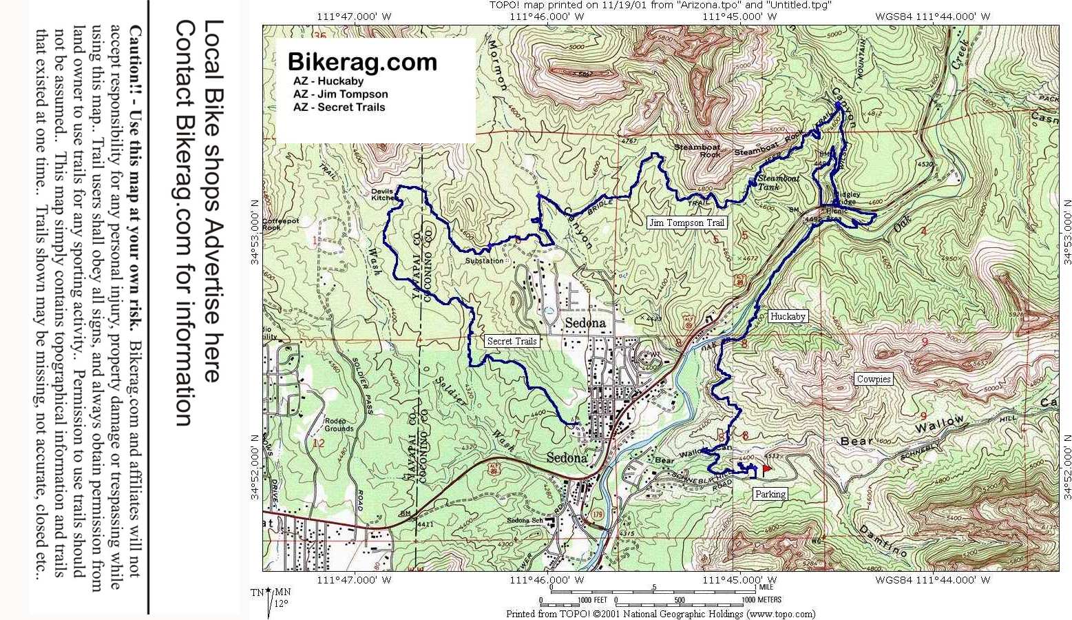
| Description - Ok - take
those wedding pictures and get on your bike for a quick single track
decent with some loose rocks, followed by killer kook uphill that almost
killed focker (the legend).. On the downhill side it gets steep with
some exposure (only if you fall). Cool trail on the side of the
mountain, carves by a couple large boulders - cool views of the oak creek
valley with steel bridge in the distance. Steep steps, behind the
seat or over the bars - take your pick.. Onward the trail follows
the creek and eventually crosses it over some rocks and planks. To
Loose double track climb that curves under bridge at top. Combine
with Jim Tompson and secret trails for an EPICly awesome day. Ride
through town on the way home, up schnebly road and look for cow
pies. We never found them so let me know.. |
| Pre-ride Music: BIlly
Idol - White Wedding |
| Total Miles: 8 |
| Elevation Change Feet - Elevation
Profile |


