|
|
|
|
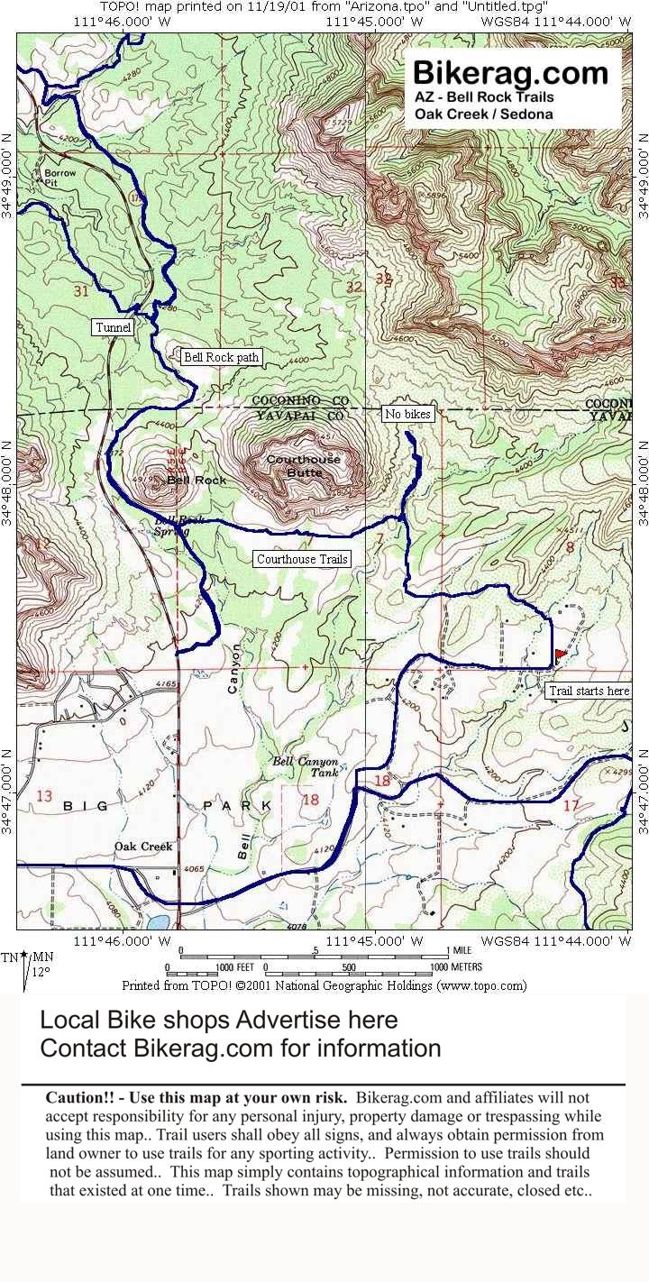
| Bell rock trail map | Map Legend | Bikerag Pics |
|
AZ - Bell Rock Mountain Bike Trail Review with Map and Pictures
|
|||||||||
| Category:
|
Overall Rating in Buckets |
 |
|||||||
| Adventure | Climbing | Free-ride | Fun | Fear | Trail Enhancements | Scenery | Techs | ||
| 3 | 1 | 0 | 3 | 1 | 0 | 4 | 2 | 2.75 | |
|
|
GPS Files - (Contact Bikerag To Upload Your files) |
|||
|
Google Earth |
GPX Map File |
GPX Routes |
Other |
|
|
For PERSONAL use only - Please read our GPS info page |
||||
| Description - The bell rock pathway is just a wide fire road that is totally lame, but gets you from point A - B. Good connector between subrock / chicken point and oak creek area. On the sothern side of bell rock there is some really good single track that even has a few technicalities. Finding the start of the ridge trail is a bit tricky from the road - I would just ask the girl playing basketball like we did, actually from jacks canyon road, keep going straight on lee, eventually there is a dead end sign and the road kind of splits, bear left and you will see a trail along a fence that leads to the single track.. | ||||||||||||||||||
| Pre-ride Music: ac dc - hells bells | ||||||||||||||||||
| Total Miles: 10 | ||||||||||||||||||
| Elevation Change Feet 700- Elevation Profile | ||||||||||||||||||
|


