|
|
|
|
| Topo Trail Map | Map Legend |


|
CA - Tamarancho -Mountain Bike Trail Review with Map and Pictures Review By Cecil - Thanks |
||||||||||||||||||||||||||||||||||||||||||||||||||||
|
||||||||||||||||||||||||||||||||||||||||||||||||||||
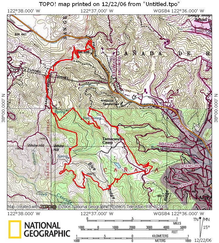
| Directions - From San Francisco, head north to
the Sir Francis Drake exit and go west. Go left on Center. Then right on,
Pacheco Ave, then go left back on to Sir Francis Drake, and follow this to
the town of Fairfax. Park in Fairfax and follow route on Boy Scout map. If
using Whites Hill Bridge access continue on Sir Francis Drake Blvd though
the town of Fairfax for approx 3 miles and park in a large dirt area on
right before the bridge. Description - The
Tamarancho trail is a loop on several different single-track trails on land
owned by the Boy Scouts. To use the trails they require you to buy a day
pass for five dollars or a year pass for forty dollars. A pass and a map of
the trails are available online at
www.boyscouts-marin.org. Some may not want to pay to ride but this is
some of the sweetest single track in the area. The loop takes you through
open hillsides to old growth forest that will keep your head on a swivel
weaving in and out of trees on tight fast single track the whole time. The
loop is best ridden clockwise but either direction is fun.
Loops - |
||||||||||||||||||||||||||||||||||||||||||||||||||||
| Pre-ride Music: | ||||||||||||||||||||||||||||||||||||||||||||||||||||
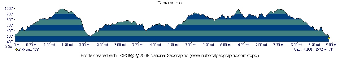
| Total Miles: Miles 9.25 | ||||||||||||||||||||||||||||||||||||||||||||||||||||
|
Elevation Change Feet -2482FT
|
||||||||||||||||||||||||||||||||||||||||||||||||||||
|
||||||||||||||||||||||||||||||||||||||||||||||||||||
| Disclaimer: Caution - Use this map at your own risk. Bikerag.com and affiliates will not accept responsibility for an personal injury, property damage or trespassing while using this map. Trail users shall obey all signs, and always obtain permission from the land owner to use trails for any sporting activity. Permission to use trails should not be assumed. This map simply contains topographical information and trails that existed at one time. Trails shown maybe be missing, not accurate, closed, overgrown etc.... | ||||||||||||||||||||||||||||||||||||||||||||||||||||
| To
view larger version of map, right click on map and select View Image.
|
||||||||||||||||||||||||||||||||||||||||||||||||||||